Area Overview for CB7 5FT
Photos of CB7 5FT
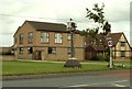
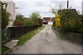
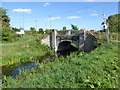
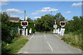

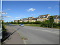
34 photos from this area
Area Information
Key information about the CB7 5FT including its size, population, and administrative classification.
- Area Type
- Postcode
- Area Size
- 9793 m²
- Population
- Not available
- Population Density
- Not available
House Prices in CB7 5FT
22
Properties
£185,266
Average Sold Price
£82,950
Lowest Price
£325,000
Highest Price
Showing 22 properties
| Address | Type | Beds | Baths | Last Sale Price | Last Sale Date | |
|---|---|---|---|---|---|---|
| 38 Cloverfield Drive, Soham, CB7 5FT | Detached | 3 | 2 | £325,000 | Sep 2024 | |
| 4 Cloverfield Drive, Soham, CB7 5FT | house | - | - | £257,500 | Mar 2021 | |
| 26 Cloverfield Drive, Soham, CB7 5FT | Detached | 3 | 1 | £289,000 | Jan 2018 | |
| 2 Cloverfield Drive, Soham, CB7 5FT | Detached | 3 | - | £290,000 | Jul 2016 | |
| 20 Cloverfield Drive, Soham, CB7 5FT | house | - | - | £209,950 | Jan 2014 | |
| 28 Cloverfield Drive, Soham, CB7 5FT | Detached | 3 | 1 | £188,000 | May 2012 | |
| 8 Cloverfield Drive, Soham, CB7 5FT | house | 3 | - | £183,500 | Dec 2011 | |
| 14 Cloverfield Drive, Soham, CB7 5FT | Detached | 3 | - | £181,500 | May 2011 | |
| 40 Cloverfield Drive, Soham, CB7 5FT | house | 4 | - | £186,000 | Apr 2011 | |
| 11 Cloverfield Drive, Soham, CB7 5FT | house | 3 | - | £154,500 | Apr 2011 |
Page 1 of 3
Energy Efficiency in CB7 5FT
Amenities
Schools
| Rank | School | Type | Entry gender | Ages |
|---|
Explore more schools in this area
Go to Schools tabDemographics
Household Size
Family (3-5 people)
most common
Accommodation Type
Houses
most common
Tenure
64
majority
Ethnic Group
White
most common
Religion
N/A
most common
Household Composition
N/A
most common
Age
47
median
Adults (30-64 years)
most common
Household Deprivation
N/A
with no deprivation
NS-SEC
38
in Lower managerial occupations
Explore more demographic insights in this area
Go to Demographics tabPlanning
Planning Constraints
- Flood RiskPremium
- Ramsar Wetland SitesPremium
- Area of Outstanding Natural BeautyPremium
- Protected Nature ReservePremium
- Protected WoodlandPremium