Area Overview for CB7 5FS
Photos of CB7 5FS
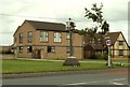
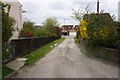
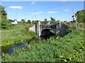
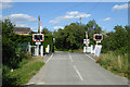

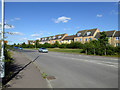

34 photos from this area
Area Information
Key information about the CB7 5FS including its size, population, and administrative classification.
- Area Type
- Postcode
- Area Size
- 7749 m²
- Population
- Not available
- Population Density
- Not available
House Prices in CB7 5FS
13
Properties
£153,723
Average Sold Price
£57,000
Lowest Price
£330,000
Highest Price
Showing 13 properties
| Address | Type | Beds | Baths | Last Sale Price | Last Sale Date | |
|---|---|---|---|---|---|---|
| 48 Cloverfield Drive, Soham, CB7 5FS | Detached | 4 | 2 | £312,500 | Apr 2020 | |
| 50 Cloverfield Drive, Soham, CB7 5FS | Detached | 4 | 1 | £330,000 | Apr 2019 | |
| 54 Cloverfield Drive, Soham, CB7 5FS | Detached | 3 | 2 | £203,500 | Mar 2014 | |
| 3 Cloverfield Drive, Soham, CB7 5FS | Semi-detached | 2 | 1 | £146,500 | Nov 2013 | |
| 15 Cloverfield Drive, Soham, CB7 5FS | Detached | - | - | £195,000 | Nov 2004 | |
| 46 Cloverfield Drive, Soham, CB7 5FS | Detached | 3 | - | £98,000 | Sep 2000 | |
| 44 Cloverfield Drive, Soham, CB7 5FS | Detached | - | - | £97,500 | Jun 2000 | |
| 9 Cloverfield Drive, Soham, CB7 5FS | Terraced | - | - | £78,000 | Sep 1999 | |
| 1 Cloverfield Drive, Soham, CB7 5FS | Detached | - | - | £81,000 | Sep 1998 | |
| 52 Cloverfield Drive, Soham, CB7 5FS | Semi-detached | - | - | £91,950 | May 1998 |
Page 1 of 2
Energy Efficiency in CB7 5FS
Amenities
Schools
| Rank | School | Type | Entry gender | Ages |
|---|
Explore more schools in this area
Go to Schools tabDemographics
Household Size
Family (3-5 people)
most common
Accommodation Type
Houses
most common
Tenure
64
majority
Ethnic Group
White
most common
Religion
N/A
most common
Household Composition
N/A
most common
Age
47
median
Adults (30-64 years)
most common
Household Deprivation
N/A
with no deprivation
NS-SEC
38
in Lower managerial occupations
Explore more demographic insights in this area
Go to Demographics tabPlanning
Planning Constraints
- Flood RiskPremium
- Ramsar Wetland SitesPremium
- Area of Outstanding Natural BeautyPremium
- Protected Nature ReservePremium
- Protected WoodlandPremium