Area Overview for CB7 4SY
Photos of CB7 4SY
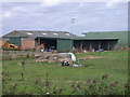
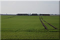
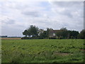
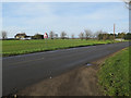
5 photos from this area
Area Information
Key information about the CB7 4SY including its size, population, and administrative classification.
- Area Type
- Postcode
- Area Size
- 11.9 km²
- Population
- 1770
- Population Density
- 45 people/km²
House Prices in CB7 4SY
47
Properties
£200,883
Average Sold Price
£98,000
Lowest Price
£285,000
Highest Price
Showing 47 properties
| Address | Type | Beds | Baths | Last Sale Price | Last Sale Date | |
|---|---|---|---|---|---|---|
| Brendon, Mildenhall Road, Littleport, CB7 4SY | Bungalow | - | - | £209,950 | Nov 2021 | |
| 48 Mildenhall Road, Littleport, CB7 4SY | Bungalow | 3 | - | £222,500 | May 2014 | |
| Rising Sun, Mildenhall Road, Littleport, CB7 4SY | Bungalow | 2 | 2 | £285,000 | Apr 2014 | |
| Hundreds Farm Bungalow, Mildenhall Road, Littleport, CB7 4SY | Bungalow | 4 | 2 | £249,995 | Mar 2014 | |
| Freedom House, 51 Mildenhall Road, Littleport, CB7 4SY | Detached | 3 | - | £235,000 | Oct 2013 | |
| 50 Mildenhall Road, Littleport, CB7 4SY | Terraced | 2 | 1 | £197,500 | Oct 2010 | |
| Selda, Mildenhall Road, Littleport, CB7 4SY | Bungalow | 3 | 1 | £160,000 | Aug 2007 | |
| Bridge House, 1 Mildenhall Road, Littleport, CB7 4SY | house | - | - | £150,000 | Feb 2007 | |
| Bircham Farm, Mildenhall Road, Littleport, CB7 4SY | Detached | - | - | £98,000 | Jul 1995 | |
| 53 Mildenhall Road, Littleport, CB7 4SY | Land | 2 | 2 | - | - |
Page 1 of 5
Energy Efficiency in CB7 4SY
Amenities
Schools
| Rank | School | Type | Entry gender | Ages |
|---|
Explore more schools in this area
Go to Schools tabDemographics
Household Size
Two person
most common
Accommodation Type
Houses
most common
Tenure
60
majority
Ethnic Group
White
most common
Religion
N/A
most common
Household Composition
N/A
most common
Age
47
median
Adults (30-64 years)
most common
Household Deprivation
N/A
with no deprivation
NS-SEC
29
in Lower managerial occupations
Explore more demographic insights in this area
Go to Demographics tabPlanning
Planning Constraints
- Flood RiskPremium
- Ramsar Wetland SitesPremium
- Area of Outstanding Natural BeautyPremium
- Protected Nature ReservePremium
- Protected WoodlandPremium