Area Overview for CB6 3WD
Photos of CB6 3WD
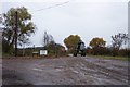
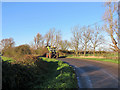
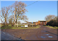
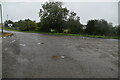
31 photos from this area
Area Information
Key information about the CB6 3WD including its size, population, and administrative classification.
- Area Type
- Postcode
- Area Size
- 2.7 hectares
- Population
- 2010
- Population Density
- 3217 people/km²
House Prices in CB6 3WD
81
Properties
£254,455
Average Sold Price
£90,000
Lowest Price
£712,500
Highest Price
Showing 81 properties
| Address | Type | Beds | Baths | Last Sale Price | Last Sale Date | |
|---|---|---|---|---|---|---|
| 171 Beresford Road, Ely, CB6 3WD | Terraced | 3 | 2 | £350,000 | Dec 2025 | |
| 122 Beresford Road, Ely, CB6 3WD | house | 3 | 2 | £355,000 | Jul 2025 | |
| 115 Beresford Road, Ely, CB6 3WD | Terraced | 3 | 2 | £345,000 | May 2025 | |
| 148 Beresford Road, Ely, CB6 3WD | Detached | 5 | 3 | £610,000 | Oct 2024 | |
| 117 Beresford Road, Ely, CB6 3WD | Terraced | 4 | 2 | £328,000 | Apr 2024 | |
| 133 Beresford Road, Ely, CB6 3WD | house | - | - | £275,000 | Oct 2023 | |
| 177 Beresford Road, Ely, CB6 3WD | Terraced | 2 | 1 | £277,000 | Jul 2023 | |
| 161 Beresford Road, Ely, CB6 3WD | house | 2 | 1 | £268,000 | Jun 2023 | |
| 119 Beresford Road, Ely, CB6 3WD | house | 3 | 2 | £315,500 | Dec 2022 | |
| 164 Beresford Road, Ely, CB6 3WD | house | - | - | £712,500 | Dec 2022 |
Page 1 of 9
Energy Efficiency in CB6 3WD
Amenities
Schools
| Rank | School | Type | Entry gender | Ages |
|---|
Explore more schools in this area
Go to Schools tabDemographics
Household Size
Family (3-5 people)
most common
Accommodation Type
Houses
most common
Tenure
77
majority
Ethnic Group
White
most common
Religion
N/A
most common
Household Composition
N/A
most common
Age
47
median
Adults (30-64 years)
most common
Household Deprivation
N/A
with no deprivation
NS-SEC
54
in Lower managerial occupations
Explore more demographic insights in this area
Go to Demographics tabPlanning
Planning Constraints
- Flood RiskPremium
- Ramsar Wetland SitesPremium
- Area of Outstanding Natural BeautyPremium
- Protected Nature ReservePremium
- Protected WoodlandPremium