Area Overview for CB6 3SG
Photos of CB6 3SG
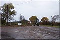
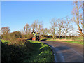
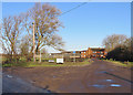
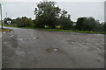

31 photos from this area
Area Information
Key information about the CB6 3SG including its size, population, and administrative classification.
- Area Type
- Postcode
- Area Size
- 1.3 hectares
- Population
- 2405
- Population Density
- 501 people/km²
House Prices in CB6 3SG
14
Properties
£356,988
Average Sold Price
£225,995
Lowest Price
£540,000
Highest Price
Showing 14 properties
| Address | Type | Beds | Baths | Last Sale Price | Last Sale Date | |
|---|---|---|---|---|---|---|
| 190 Beresford Road, Ely, CB6 3SG | house | 4 | - | £540,000 | Mar 2023 | |
| 128 Beresford Road, Ely, CB6 3SG | Terraced | 3 | 2 | £303,000 | Jun 2021 | |
| 186 Beresford Road, Ely, CB6 3SG | Detached | 4 | 2 | £430,000 | Oct 2020 | |
| 172 Beresford Road, Ely, CB6 3SG | Detached | 4 | 1 | £470,000 | Sep 2018 | |
| 174 Beresford Road, Ely, CB6 3SG | house | 4 | - | £274,950 | Apr 2012 | |
| 168 Beresford Road, Ely, CB6 3SG | house | 5 | - | £360,000 | Feb 2012 | |
| 166 Beresford Road, Ely, CB6 3SG | house | 4 | - | £349,000 | May 2011 | |
| 178 Beresford Road, Ely, CB6 3SG | house | 4 | - | £259,950 | Apr 2010 | |
| 170 Beresford Road, Ely, CB6 3SG | Detached | - | - | £225,995 | Nov 2003 | |
| 182 Beresford Road, Ely, CB6 3SG | house | 6 | 4 | - | - |
Page 1 of 2
Energy Efficiency in CB6 3SG
Amenities
Schools
| Rank | School | Type | Entry gender | Ages |
|---|
Explore more schools in this area
Go to Schools tabDemographics
Household Size
Two person
most common
Accommodation Type
Houses
most common
Tenure
69
majority
Ethnic Group
White
most common
Religion
N/A
most common
Household Composition
N/A
most common
Age
47
median
Adults (30-64 years)
most common
Household Deprivation
N/A
with no deprivation
NS-SEC
46
in Lower managerial occupations
Explore more demographic insights in this area
Go to Demographics tabPlanning
Planning Constraints
- Flood RiskPremium
- Ramsar Wetland SitesPremium
- Area of Outstanding Natural BeautyPremium
- Protected Nature ReservePremium
- Protected WoodlandPremium