Area Overview for CB6 2PD
Photos of CB6 2PD
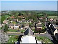
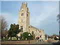
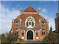
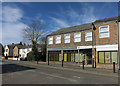
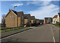
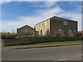
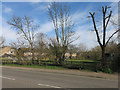

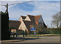
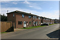
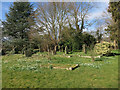
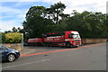
77 photos from this area
Area Information
Key information about the CB6 2PD including its size, population, and administrative classification.
- Area Type
- Postcode
- Area Size
- 41.3 hectares
- Population
- 2012
- Population Density
- 700 people/km²
House Prices in CB6 2PD
58
Properties
£254,834
Average Sold Price
£66,000
Lowest Price
£465,000
Highest Price
Showing 58 properties
| Address | Type | Beds | Baths | Last Sale Price | Last Sale Date | |
|---|---|---|---|---|---|---|
| 27 The Row, Sutton, CB6 2PD | Bungalow | 3 | 1 | £395,000 | Jun 2025 | |
| 1 The Row, Sutton, CB6 2PD | Bungalow | 3 | 1 | £380,000 | Aug 2024 | |
| 8B The Row, Sutton, CB6 2PD | Detached | 4 | 2 | £400,000 | Feb 2023 | |
| 40 The Row, Sutton, CB6 2PD | Bungalow | 3 | 2 | £385,000 | Feb 2023 | |
| 35A The Row, Sutton, CB6 2PD | Detached | 3 | - | £420,000 | Jun 2021 | |
| 8 The Row, Sutton, CB6 2PD | Detached | 4 | 2 | £390,000 | May 2021 | |
| 48 The Row, Sutton, CB6 2PD | Detached | 2 | 1 | £205,500 | Mar 2021 | |
| 44 The Row, Sutton, CB6 2PD | Bungalow | 3 | 1 | £215,000 | Aug 2020 | |
| 34 The Row, Sutton, CB6 2PD | Detached | 3 | 1 | £320,000 | Jun 2019 | |
| 6 The Row, Sutton, CB6 2PD | Detached | 3 | - | £270,000 | Jun 2019 |
Page 1 of 6
Energy Efficiency in CB6 2PD
Amenities
Schools
| Rank | School | Type | Entry gender | Ages |
|---|
Explore more schools in this area
Go to Schools tabDemographics
Household Size
Two person
most common
Accommodation Type
Houses
most common
Tenure
88
majority
Ethnic Group
White
most common
Religion
N/A
most common
Household Composition
N/A
most common
Age
47
median
Adults (30-64 years)
most common
Household Deprivation
N/A
with no deprivation
NS-SEC
45
in Lower managerial occupations
Explore more demographic insights in this area
Go to Demographics tabPlanning
Planning Constraints
- Flood RiskPremium
- Ramsar Wetland SitesPremium
- Area of Outstanding Natural BeautyPremium
- Protected Nature ReservePremium
- Protected WoodlandPremium