Area Overview for CB6 2NW
Photos of CB6 2NW
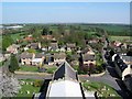
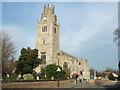
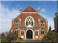
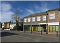

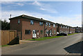
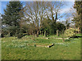
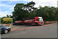
77 photos from this area
Area Information
Key information about the CB6 2NW including its size, population, and administrative classification.
- Area Type
- Postcode
- Area Size
- 3.2 hectares
- Population
- 2012
- Population Density
- 700 people/km²
House Prices in CB6 2NW
56
Properties
£214,051
Average Sold Price
£52,000
Lowest Price
£485,000
Highest Price
Showing 56 properties
| Address | Type | Beds | Baths | Last Sale Price | Last Sale Date | |
|---|---|---|---|---|---|---|
| 111 High Street, Sutton, CB6 2NW | Detached | 2 | - | £230,000 | Nov 2022 | |
| 97A High Street, Sutton, CB6 2NW | house | 4 | - | £445,000 | Mar 2022 | |
| 89 High Street, Sutton, CB6 2NW | Detached | 4 | - | £455,000 | Feb 2022 | |
| Orchard House, 129 High Street, Sutton, CB6 2NW | Detached | 5 | 2 | £485,000 | Nov 2021 | |
| 84 High Street, Sutton, CB6 2NW | Detached | 3 | 1 | £200,000 | Feb 2020 | |
| 97 High Street, Sutton, CB6 2NW | Detached | 5 | 2 | £382,000 | Jul 2019 | |
| 96 High Street, Sutton, CB6 2NW | Detached | 3 | 3 | £305,000 | Nov 2016 | |
| 91 High Street, Sutton, CB6 2NW | Detached | 3 | 1 | £272,000 | Mar 2016 | |
| 87 High Street, Sutton, CB6 2NW | Semi-detached | 4 | 2 | £205,000 | Jun 2014 | |
| 119 High Street, Sutton, CB6 2NW | Detached | 4 | - | £379,950 | Jan 2014 |
Page 1 of 6
Energy Efficiency in CB6 2NW
Amenities
Schools
| Rank | School | Type | Entry gender | Ages |
|---|
Explore more schools in this area
Go to Schools tabDemographics
Household Size
Two person
most common
Accommodation Type
Houses
most common
Tenure
88
majority
Ethnic Group
White
most common
Religion
N/A
most common
Household Composition
N/A
most common
Age
47
median
Adults (30-64 years)
most common
Household Deprivation
N/A
with no deprivation
NS-SEC
45
in Lower managerial occupations
Explore more demographic insights in this area
Go to Demographics tabPlanning
Planning Constraints
- Flood RiskPremium
- Ramsar Wetland SitesPremium
- Area of Outstanding Natural BeautyPremium
- Protected Nature ReservePremium
- Protected WoodlandPremium