Area Overview for CB6 1NS
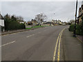
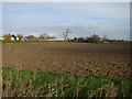
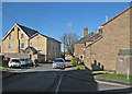
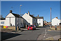
Photos of CB6 1NS
Area Information
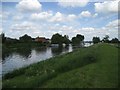
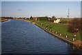
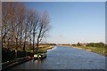
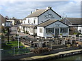
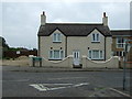
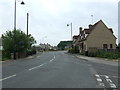
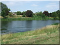
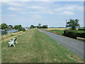
Living in CB6 1NS, a small residential postcode in East Cambridgeshire, means being part of a tightly knit community of 2,286 people spread across 18.6 hectares. This area, part of the village of Littleport, sits on the River Great Ouse, blending historical charm with practical modernity. The population density of 238 people per square kilometre suggests a balance between rural tranquillity and suburban convenience. Littleport’s heritage is evident in its landmarks, including a Grade II-listed ironmonger’s shop and a Harley-Davidson statue marking its local ties. Daily life here is shaped by proximity to Ely, with rail links to nearby towns and a mix of traditional and contemporary amenities. The area’s compact size means residents are close to nature, with nearby wetlands and historical sites, yet within reach of essential services. It is a place where history and modernity coexist, offering a unique blend of character and accessibility for those seeking a stable, community-focused lifestyle.
- Area Type
- Postcode
- Area Size
- 18.6 hectares
- Population
- 2286
- Population Density
- 238 people/km²
The property market in CB6 1NS is characterised by high home ownership (73%) and a predominance of houses over flats or apartments. This suggests a market skewed towards owner-occupied properties, with limited rental availability. The small area size (18.6 hectares) and population (2,286) indicate a compact, low-density housing stock, likely featuring larger homes typical of rural or semi-rural settings. Buyers should consider the limited land area, which may restrict new developments and keep property values stable. The focus on houses implies a demand for family homes or properties with garden space, appealing to those prioritising privacy and space. However, the small size of the area means competition for properties could be fierce, and buyers must evaluate the long-term viability of investing in a niche market with limited expansion potential.
House Prices in CB6 1NS
Showing 21 properties
| Address | Type | Beds | Baths | Last Sale Price | Last Sale Date | |
|---|---|---|---|---|---|---|
| 5 Padnal, Littleport, CB6 1NS | house | - | - | £215,000 | Dec 2020 | |
| Blue Blaise, Padnal, Littleport, CB6 1NS | Bungalow | - | - | £363,750 | Nov 2018 | |
| Barley Field House, Padnal, Littleport, CB6 1NS | house | - | - | £318,000 | Nov 2015 | |
| 3 Padnal, Littleport, CB6 1NS | Semi-detached | 3 | 1 | £120,000 | Dec 2012 | |
| Sharrock Lodge, Padnal, Littleport, CB6 1NS | Detached | - | - | £145,000 | May 2009 | |
| The Willows, 2 Padnal, Littleport, CB6 1NS | Semi-detached | 3 | 2 | £115,000 | Feb 1997 | |
| Fieldside, Padnal, Littleport, CB6 1NS | house | 4 | 1 | - | - | |
| Rijon, Padnal, Littleport, CB6 1NS | Land | - | - | - | - | |
| 1B Padnal, Littleport, CB6 1NS | Semi-detached | 3 | 2 | - | - | |
| 1 Padnal, Littleport, CB6 1NS | Semi-detached | 4 | 3 | - | - |
Energy Efficiency in CB6 1NS
The lifestyle in CB6 1NS is shaped by its proximity to Littleport’s historical and retail amenities. Within practical reach are five retail venues, including Co-op Main, Co-op Wisbech, and M&S Littleport BP, offering everyday shopping needs. The area’s rail stations provide access to broader networks, while the village itself retains a distinct character with landmarks like the Adams Heritage Centre and the Harley-Davidson statue. The A10 road connects to nearby towns, and the surrounding landscape includes wetlands and historical sites, offering opportunities for walking or nature-focused activities. While the immediate area lacks large-scale leisure facilities, the nearby towns of Ely and Cambridge provide additional options. The combination of practical retail access, historical interest, and transport links creates a lifestyle that balances rural tranquillity with urban accessibility.
Amenities
Schools
The nearest school to CB6 1NS is Millfield Primary School, which serves the area’s primary education needs. The school has an Ofsted rating of ‘good’, indicating a satisfactory standard of teaching and facilities. As the only listed school in the data, it is the sole primary institution within practical reach, though secondary education options would require travel to nearby towns like Ely or Cambridge. The presence of a ‘good’-rated primary school suggests a baseline of quality for early education, but families requiring secondary schooling may need to factor in commute times or consider boarding options. The lack of additional schools in the immediate vicinity highlights the importance of assessing transport links and alternative educational provisions for older children.
| Rank | School | Type | Entry gender | Ages |
|---|
Explore more schools in this area
Go to Schools tabDemographics
The demographic profile of CB6 1NS reflects a mature, established community. The median age is 47, with the majority of residents aged 30–64, indicating a population skewed towards middle-aged adults. Home ownership is high, at 73%, with houses being the predominant type of accommodation. This suggests a stable, long-term resident base rather than a transient rental market. The predominant ethnic group is White, with no specific data on other demographics provided. The population density of 238 people per square kilometre implies a mix of family homes and single-occupancy properties, though the exact distribution of household types is not detailed. The age range and ownership figures suggest a community focused on stability, with fewer young families or students compared to other areas. This profile may appeal to professionals or retirees seeking a quiet, low-traffic environment with strong local ties.
Household Size
Accommodation Type
Tenure
Ethnic Group
Religion
Household Composition
Age
Household Deprivation
NS-SEC
Explore more demographic insights in this area
Go to Demographics tabPlanning
Planning Constraints
- Flood RiskPremium
- Ramsar Wetland SitesPremium
- Area of Outstanding Natural BeautyPremium
- Protected Nature ReservePremium
- Protected WoodlandPremium