Area Overview for CB6 1LN
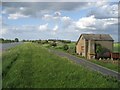
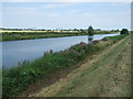
Photos of CB6 1LN


Area Information
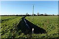
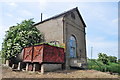
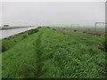
Living in CB6 1LN, a small residential cluster in East Cambridgeshire, offers a blend of historical significance and practical convenience. The area covers 4.2 hectares and is home to 2,286 residents, with a population density of 238 people per square kilometre. Situated six miles north of Ely, it lies along the River Great Ouse, near the historic hamlet of Little Ouse, which holds Britain’s lowest trig point. The village of Littleport, part of the postcode district, is steeped in history, from its Domesday Book origins to the 1816 riots and the 2003 Harley-Davidson statue. Residents benefit from proximity to Ely’s amenities and the A10 road, while the area’s compact size fosters a tight-knit community. With a median age of 47, the population skews towards adults aged 30–64, suggesting a stable, established demographic. The presence of a primary school and three railway stations within reach adds to the area’s appeal for families and commuters. CB6 1LN is a quiet, historically rich postcode, ideal for those seeking a balance between rural charm and accessible infrastructure.
- Area Type
- Postcode
- Area Size
- 4.2 hectares
- Population
- 2286
- Population Density
- 238 people/km²
The property market in CB6 1LN is characterised by a high rate of home ownership (73%) and a predominance of houses. This suggests a market skewed towards owner-occupation rather than rental properties, which is typical of smaller, rural postcodes. The presence of houses rather than flats or apartments indicates a focus on family-friendly, spacious living, aligning with the area’s demographic of adults aged 30–64. Given the small size of the postcode (4.2 hectares), the housing stock is likely limited, with properties concentrated in the village of Littleport. Buyers should consider the compact nature of the area, which may limit availability of new builds or larger properties. The high home ownership rate also implies strong local ties, with properties potentially holding long-term value. For those seeking a stable, low-turnover market, CB6 1LN offers a mix of historical charm and practicality, though the small size means competition for available homes may be keen.
House Prices in CB6 1LN
Showing 48 properties
| Address | Type | Beds | Baths | Last Sale Price | Last Sale Date | |
|---|---|---|---|---|---|---|
| 71 Fishers Bank, Littleport, CB6 1LN | Terraced | 3 | 2 | £230,000 | Oct 2024 | |
| 53 Fishers Bank, Littleport, CB6 1LN | Semi-detached | 3 | 2 | £234,500 | Jun 2024 | |
| 42 Fishers Bank, Littleport, CB6 1LN | Detached | 3 | 2 | £245,000 | Dec 2023 | |
| 57 Fishers Bank, Littleport, CB6 1LN | Semi-detached | 4 | 2 | £300,200 | Nov 2022 | |
| 80 Fishers Bank, Littleport, CB6 1LN | Detached | 3 | 1 | £215,000 | Feb 2021 | |
| 69 Fishers Bank, Littleport, CB6 1LN | Semi-detached | 4 | 2 | £282,500 | Sep 2020 | |
| 72 Fishers Bank, Littleport, CB6 1LN | Semi-detached | 3 | 2 | £210,000 | Apr 2020 | |
| 77 Fishers Bank, Littleport, CB6 1LN | Semi-detached | 3 | - | £220,000 | Mar 2019 | |
| 54 Fishers Bank, Littleport, CB6 1LN | Terraced | 3 | 2 | £220,000 | Dec 2017 | |
| 58 Fishers Bank, Littleport, CB6 1LN | Semi-detached | 3 | - | £230,000 | Sep 2016 |
Energy Efficiency in CB6 1LN
Residents of CB6 1LN have access to a range of local amenities within practical reach. The area is served by five retail outlets, including Co-op Main, Co-op Wisbech, and M&S Littleport BP, providing essential shopping and dining options. The presence of three railway stations—Littleport, Shippea Hill, and Ely—ensures easy access to larger towns and cities, enhancing connectivity for both leisure and work. While the data does not specify parks or leisure facilities, the village of Littleport itself offers historical and cultural attractions, such as the Grade II-listed Adams Heritage Centre and the Harley-Davidson statue. The compact size of the postcode means amenities are concentrated, fostering a sense of convenience. For those seeking a blend of rural tranquillity and accessible services, CB6 1LN offers a lifestyle that balances local charm with practicality.
Amenities
Schools
The nearest school to CB6 1LN is Millfield Primary School, which serves the local community with a good Ofsted rating. As a primary school, it caters to children aged 4–11, providing essential early education for families in the area. The presence of a single primary school suggests that secondary education options may be located in nearby towns such as Ely or Wisbech, requiring commuting for older students. The good rating indicates that the school meets national standards in teaching quality and student outcomes. For families prioritising proximity to schools, Millfield Primary School offers a reliable option, though parents should consider the need for additional transport arrangements for secondary schooling. The school’s performance also reflects positively on the area’s commitment to education, reinforcing its appeal for families seeking a balanced lifestyle.
| Rank | School | Type | Entry gender | Ages |
|---|
Explore more schools in this area
Go to Schools tabDemographics
The community in CB6 1LN is predominantly composed of adults aged 30–64, with a median age of 47. This suggests a mature, settled population, likely with long-term ties to the area. Home ownership is high, with 73% of residents owning their homes, indicating a stable housing market. The accommodation type is primarily houses, reflecting a residential character that contrasts with more densely populated areas. The predominant ethnic group is White, though no specific data on diversity or deprivation is provided. The population density of 238 people per square kilometre is moderate for a rural postcode, balancing privacy with community interaction. This demographic profile suggests a low turnover of residents, with families and professionals forming the core of the community. The absence of detailed diversity metrics means the area’s social composition remains largely unexplored in public data, but the high home ownership rate and age distribution point to a cohesive, long-established neighbourhood.
Household Size
Accommodation Type
Tenure
Ethnic Group
Religion
Household Composition
Age
Household Deprivation
NS-SEC
Explore more demographic insights in this area
Go to Demographics tabPlanning
Planning Constraints
- Flood RiskPremium
- Ramsar Wetland SitesPremium
- Area of Outstanding Natural BeautyPremium
- Protected Nature ReservePremium
- Protected WoodlandPremium