Area Overview for CB5 8XB
Photos of CB5 8XB

Area Information
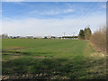
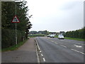
Living in CB5 8XB means being part of a small, tightly knit residential cluster on the northeast edge of Cambridge, England. The area spans 9,244 square metres and is home to 1,689 residents, creating a low-density, community-focused environment. Its proximity to Cambridge offers easy access to the city’s cultural and professional hubs, while its historical roots beside the River Cam and the Fleam Dyke earthwork add a distinct character. The median age of 47 suggests a mature population, with adults aged 30–64 forming the largest demographic group. Daily life here balances quiet residential living with practical connectivity—rail stations, airports, and retail outlets are within reach. The area’s Conservation Area status and historic sites, such as the 12th-century St Mary the Virgin church, reflect its heritage, while modern amenities like broadband and mobile networks support contemporary lifestyles. CB5 8XB is ideal for those seeking a blend of tranquillity and accessibility, with a community that values both history and convenience.
- Area Type
- Postcode
- Area Size
- 9244 m²
- Population
- 1689
- Population Density
- 83 people/km²
CB5 8XB is a predominantly owner-occupied area, with 63% of homes owned by their residents. The accommodation type is largely houses, which is typical for small rural or semi-rural clusters. This suggests a housing stock that prioritises private, family-oriented living over rental properties. The small size of the area—just 9,244 square metres—means the property market is limited, with few homes available for purchase. Buyers should consider nearby areas for more options, though the proximity to Cambridge may offer additional opportunities. The focus on houses rather than flats indicates a preference for larger, more permanent residences, which could appeal to families or those seeking long-term stability. However, the limited stock means competition may be keen, and buyers should act swiftly when opportunities arise.
House Prices in CB5 8XB
Showing 41 properties
| Address | Type | Beds | Baths | Last Sale Price | Last Sale Date | |
|---|---|---|---|---|---|---|
| 31 Valiant Lane, Cambridge, CB5 8XB | Retail | 2 | 1 | £91,250 | Feb 2025 | |
| 23 Valiant Lane, Cambridge, CB5 8XB | Maisonette | 3 | 1 | - | - | |
| 35 Valiant Lane, Cambridge, CB5 8XB | Flat | 1 | 1 | - | - | |
| 41 Valiant Lane, Cambridge, CB5 8XB | Flat | 1 | 1 | - | - | |
| 11 Valiant Lane, Cambridge, CB5 8XB | Flat | 2 | 2 | - | - | |
| 39 Valiant Lane, Cambridge, CB5 8XB | Retail | 2 | 1 | - | - | |
| 9 Valiant Lane, Cambridge, CB5 8XB | Flat | 3 | 2 | - | - | |
| 2 Valiant Lane, Cambridge, CB5 8XB | Flat | - | - | - | - | |
| 45 Valiant Lane, Cambridge, CB5 8XB | Flat | - | - | - | - | |
| 71 Valiant Lane, Cambridge, CB5 8XB | Flat | - | - | - | - |
Energy Efficiency in CB5 8XB
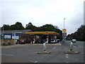
The lifestyle in CB5 8XB is shaped by its proximity to both historical sites and modern amenities. Within practical reach are five retail outlets, including M&S Teversham BP and Spar, offering convenience for shopping and daily essentials. The area’s railway stations provide access to Cambridge and other regional hubs, while two nearby airports cater to those requiring air travel. The historic River Cam and Fleam Dyke earthwork add a unique character to the area, complemented by the Grade II-listed war memorial and St Mary the Virgin church. These landmarks contribute to a sense of heritage and community identity. For leisure, the nearby conservation area and riverfront offer opportunities for walking or outdoor activities. The blend of practical amenities and historical richness creates a lifestyle that balances convenience with cultural depth, appealing to those who value both.
Amenities
Schools
Residents of CB5 8XB have access to three primary schools within practical reach: Fen Ditton Primary School and Marleigh Primary Academy. Both are primary schools, catering to younger children and providing a foundation for local education. The presence of two instances of Fen Ditton Primary School in the data may reflect administrative duplication, but the core offering remains consistent. These schools are likely to serve the needs of families in the area, though specific Ofsted ratings or academic performance metrics are not provided. The availability of primary schools is a key consideration for parents, ensuring children can attend local institutions without long commutes. The lack of secondary schools in the immediate vicinity may require families to look further afield, but the primary options available suggest a functional educational infrastructure for younger children.
| Rank | School | Type | Entry gender | Ages |
|---|
Explore more schools in this area
Go to Schools tabDemographics
The population of CB5 8XB is 1,689, with a median age of 47 and a majority of residents aged 30–64. This suggests a stable, mature community with a strong presence of working-age adults. Home ownership stands at 63%, indicating a mix of long-term residents and property investors. The area is predominantly composed of houses, reflecting a traditional housing stock rather than flats or apartments. The predominant ethnic group is White, though specific diversity metrics are not provided. The population density of 83 people per square kilometre is low, aligning with its small, residential nature. This demographic profile implies a community focused on family living and stability, with fewer transient residents. The absence of detailed deprivation data means the quality of life here cannot be assessed in terms of socioeconomic challenges, but the age and ownership figures suggest a generally secure, established population.
Household Size
Accommodation Type
Tenure
Ethnic Group
Religion
Household Composition
Age
Household Deprivation
NS-SEC
Explore more demographic insights in this area
Go to Demographics tabPlanning
Planning Constraints
- Flood RiskPremium
- Ramsar Wetland SitesPremium
- Area of Outstanding Natural BeautyPremium
- Protected Nature ReservePremium
- Protected WoodlandPremium