Area Overview for CB5 8BX
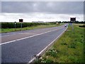
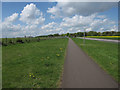
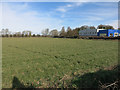
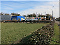
Photos of CB5 8BX
Area Information
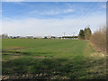
Living in CB5 8BX means being part of a small, tightly knit residential cluster in South Cambridgeshire, just northeast of Cambridge. The area covers 1.9 hectares and is home to 1,689 people, creating a quiet, low-density environment. Its historical roots are evident in its proximity to the River Cam and the Fleam Dyke earthwork, a 7th-century Anglo-Saxon defensive structure. The village of Fen Ditton, which includes this postcode, has a population of around 760 according to 2011 data, though the broader area has grown slightly. Daily life here is shaped by its rural setting, with access to nearby amenities and transport links. The area’s modest size and modest population density suggest a community that values privacy and a slower pace, with residents likely to know their neighbours. The presence of historic features like the 12th-century St Mary the Virgin church and the Grade II listed war memorial adds a layer of cultural richness. For those seeking a blend of historical interest and modern convenience, CB5 8BX offers a unique slice of Cambridgeshire life.
- Area Type
- Postcode
- Area Size
- 1.9 hectares
- Population
- 1689
- Population Density
- 83 people/km²
CB5 8BX is predominantly an owner-occupied area, with 63% of residents living in homes they own. The accommodation type is primarily houses, which is typical for small rural postcodes with limited high-density development. This suggests a housing stock that is largely traditional, with individual properties rather than flats or shared ownership schemes. The small area size and modest population mean the market is likely limited to a few dozen properties, making it a niche area for buyers seeking characterful homes in a low-rise setting. The presence of historic features, such as the 12th-century church and listed buildings, may appeal to buyers interested in heritage. However, the limited scale of the area means that property values and availability are unlikely to be influenced by broader regional trends. For buyers, this could mean a more personal, localised search, with fewer options but potentially more distinct properties to choose from.
House Prices in CB5 8BX
Showing 95 properties
| Address | Type | Beds | Baths | Last Sale Price | Last Sale Date | |
|---|---|---|---|---|---|---|
| 239 Marleigh Avenue, Cambridge, CB5 8BX | house | - | - | £689,950 | Dec 2021 | |
| 229 Marleigh Avenue, Cambridge, CB5 8BX | Semi-detached | 5 | 2 | £649,950 | Sep 2021 | |
| 225 Marleigh Avenue, Cambridge, CB5 8BX | Semi-detached | 5 | 2 | £649,950 | Sep 2021 | |
| 227 Marleigh Avenue, Cambridge, CB5 8BX | house | - | - | £649,950 | Sep 2021 | |
| 233 Marleigh Avenue, Cambridge, CB5 8BX | house | - | - | £649,950 | Sep 2021 | |
| 235 Marleigh Avenue, Cambridge, CB5 8BX | Detached | 5 | 2 | £649,950 | Sep 2021 | |
| 231 Marleigh Avenue, Cambridge, CB5 8BX | house | - | - | £649,950 | Sep 2021 | |
| 237 Marleigh Avenue, Cambridge, CB5 8BX | house | - | - | £649,950 | Aug 2021 | |
| 243 Marleigh Avenue, Cambridge, CB5 8BX | house | - | - | £659,950 | Aug 2021 | |
| 221 Marleigh Avenue, Cambridge, CB5 8BX | house | - | - | £649,950 | Dec 2020 |
Energy Efficiency in CB5 8BX
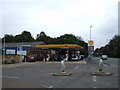
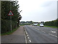
Residents of CB5 8BX have access to a range of amenities within practical reach, including five retail outlets such as Co-op Cambridge, M&S Teversham BP, and Spar. These shops provide everyday essentials, though the variety is limited compared to larger towns. The area’s proximity to Cambridge also means residents can access the city’s broader retail and dining options if needed. The nearby railway stations and Cambridge Airport enhance connectivity, allowing easy access to urban centres. The rural setting, combined with nearby amenities, creates a balance between convenience and tranquillity. The presence of the River Cam and historical sites like the St Mary the Virgin church adds to the area’s character, offering opportunities for leisure and reflection.
Amenities
Schools
The nearest schools to CB5 8BX are all primary schools, with Fen Ditton Primary School and Marleigh Primary Academy listed in the data. Both are primary institutions, though no Ofsted ratings are provided. The concentration of primary schools suggests the area is well-served for younger children, though families with older children may need to look further afield for secondary education. The presence of two primary schools within practical reach could reduce travel time for parents, particularly given the area’s proximity to Cambridge. However, the lack of secondary schools in the immediate vicinity means that students may need to commute to nearby towns for higher education. The mix of schools is limited to primary levels, which may be a consideration for families planning long-term in the area.
| Rank | School | Type | Entry gender | Ages |
|---|
Explore more schools in this area
Go to Schools tabDemographics
The population of CB5 8BX is 1,689, with a median age of 47, indicating a community skewed toward middle-aged and older adults. The most common age range is 30–64 years, suggesting a mix of families and older households. Home ownership is strong, with 63% of residents owning their homes, and the predominant accommodation type is houses, reflecting a residential area with more traditional housing stock. The predominant ethnic group is White, though specific data on diversity is not provided. The population density of 83 people per square kilometre is low, aligning with the area’s small size and rural character. This demographic profile implies a stable, established community with fewer young families compared to urban areas. The lack of detailed diversity statistics means the area’s social composition remains less defined, but the high home ownership rate and older median age suggest a focus on long-term residency and property investment.
Household Size
Accommodation Type
Tenure
Ethnic Group
Religion
Household Composition
Age
Household Deprivation
NS-SEC
Explore more demographic insights in this area
Go to Demographics tabPlanning
Planning Constraints
- Flood RiskPremium
- Ramsar Wetland SitesPremium
- Area of Outstanding Natural BeautyPremium
- Protected Nature ReservePremium
- Protected WoodlandPremium