Area Overview for CB5 8LE
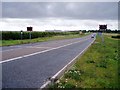
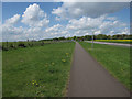
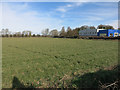
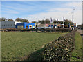
Photos of CB5 8LE
Area Information
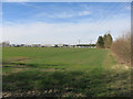
Living in CB5 8LE means being part of a small, tightly knit residential cluster in the heart of Cambridgeshire. This postcode covers 9,892 square metres, with a population of 1,689 spread across a density of 83 people per square kilometre. The area sits on the northeast edge of Cambridge, a location steeped in history. Fen Ditton, the village associated with CB5 8LE, is defined by its proximity to the River Cam and the ancient Fleam Dyke earthwork, which dates back to the 7th century. The village has long been a hub of quiet rural life, with evidence of Neolithic occupation and medieval trade routes. Today, CB5 8LE retains a village character, with homes set in a low-density layout. Its small size means residents know their neighbours, and the area’s historical significance adds a layer of cultural depth to daily life. Whether walking along the River Cam or exploring local landmarks like the 12th-century St Mary the Virgin church, living in CB5 8LE offers a blend of tranquillity and connection to the past.
- Area Type
- Postcode
- Area Size
- 9892 m²
- Population
- 1689
- Population Density
- 83 people/km²
The property market in CB5 8LE is characterised by a strong presence of owner-occupied homes, with 63% of properties owned by residents rather than rented. The accommodation type is primarily houses, which is typical for a small, low-density area like this. This suggests a market that caters to families and individuals seeking spacious, private living environments rather than high-density housing. The limited size of the area means that property availability is constrained, and buyers should consider the surrounding regions for more options. The focus on houses implies that the area is less suited to those prioritising rental flexibility or smaller units. For those looking to purchase, the market offers a chance to invest in a stable, established community with a distinct village feel. However, the small size of CB5 8LE means that property searches may need to extend beyond the immediate postcode to find a wider range of homes.
House Prices in CB5 8LE
Showing 60 properties
| Address | Type | Beds | Baths | Last Sale Price | Last Sale Date | |
|---|---|---|---|---|---|---|
| 25 Gregory Park Mews, Cambridge, CB5 8LE | Terraced | 2 | 1 | - | - | |
| 39 Gregory Park Mews, Cambridge, CB5 8LE | Terraced | 2 | 1 | - | - | |
| 41 Gregory Park Mews, Cambridge, CB5 8LE | Terraced | 2 | 1 | - | - | |
| 4 GREGORY PARK MEWS, Cambridge, CB5 8LE | Detached | - | - | - | - | |
| 59 Gregory Park Mews, Cambridge, CB5 8LE | Terraced | - | - | - | - | |
| 49 Gregory Park Mews, Cambridge, CB5 8LE | Terraced | - | - | - | - | |
| 55 Gregory Park Mews, Cambridge, CB5 8LE | Terraced | - | - | - | - | |
| 51 Gregory Park Mews, Cambridge, CB5 8LE | Terraced | - | - | - | - | |
| 61 Gregory Park Mews, Cambridge, CB5 8LE | Terraced | - | - | - | - | |
| 54 Gregory Park Mews, Cambridge, CB5 8LE | Detached | - | - | - | - |
Energy Efficiency in CB5 8LE
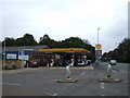
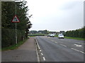
The lifestyle in CB5 8LE is shaped by its proximity to both rural tranquillity and urban connectivity. Residents have access to five retail venues, including Co-op Cambridge and Spar, which provide essentials like groceries and daily necessities. The presence of Cambridge Airport, though listed twice, underscores the area’s accessibility for travel. Rail connectivity is strong, with three stations offering links to Cambridge and surrounding areas, making commuting or day trips straightforward. The village’s historical sites, such as the River Cam and Fleam Dyke, add a unique cultural dimension to daily life. While the area is small, its amenities are sufficient for basic needs, though some residents may need to travel slightly further for specialist services. The combination of local shops, transport links, and natural features creates a balanced lifestyle, blending convenience with a sense of community.
Amenities
Schools
Residents of CB5 8LE have access to three primary schools within practical reach: Fen Ditton Primary School and Marleigh Primary Academy. Both are primary schools, catering to younger children and providing essential early education. The presence of two instances of Fen Ditton Primary School in the data may indicate a nearby campus or multiple locations, though this requires further clarification. The availability of primary schools is a key consideration for families, ensuring that children can attend local education without long commutes. However, the data does not provide Ofsted ratings or specific academic performance metrics, so prospective parents may need to conduct additional research. The concentration of primary schools in the area suggests a focus on early education, which is beneficial for families with young children. For those prioritising school quality, visiting the schools directly or consulting local education reports would be advisable.
| Rank | School | Type | Entry gender | Ages |
|---|
Explore more schools in this area
Go to Schools tabDemographics
The community in CB5 8LE is predominantly middle-aged, with a median age of 47 and the most common age range being adults aged 30–64. This suggests a stable population with strong family ties and a focus on long-term residency. Home ownership is high at 63%, with houses being the primary accommodation type. The majority of residents identify as White, reflecting the area’s demographic profile. The population density of 83 people per square kilometre indicates a low-rise, spread-out settlement pattern, which aligns with the predominance of houses over flats or apartments. This demographic profile implies a community that values privacy and stability, with fewer transient residents. The age distribution also suggests a balance between working-age adults and older residents, creating a mix of active professionals and retirees. The lack of specific data on deprivation means the area’s quality of life can be inferred from its low population density and high home ownership rates, which often correlate with higher living standards.
Household Size
Accommodation Type
Tenure
Ethnic Group
Religion
Household Composition
Age
Household Deprivation
NS-SEC
Explore more demographic insights in this area
Go to Demographics tabPlanning
Planning Constraints
- Flood RiskPremium
- Ramsar Wetland SitesPremium
- Area of Outstanding Natural BeautyPremium
- Protected Nature ReservePremium
- Protected WoodlandPremium