Area Overview for CB5 8HT
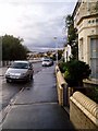
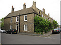
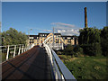
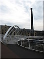
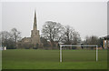
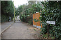
Photos of CB5 8HT


Area Information
Living in CB5 8HT means inhabiting a compact, densely populated residential cluster in Cambridge, England. With a population of 2,182 spread across just 1.1 hectares, the area is a microcosm of suburban Cambridge. Its history is rooted in 20th-century housing developments, notably the Fen Ditton Fields estate, which was integrated into the city in 1934. The area is bounded by former railway lines and natural features like Cherry Hinton brook, creating a distinct character. Residents benefit from proximity to Cambridge North Railway Station, Shelford, and Waterbeach stations, linking them to the city and beyond. Daily life here is shaped by its suburban layout, with ring-roads and major routes like Newmarket Road forming the backbone of connectivity. While small, the area is served by two airports and multiple retail outlets, including Tesco Cambridge and Aldi Newmarket. Its high population density—over 207,000 people per square kilometre—means a tight-knit community, though the limited space underscores the need for efficient planning. CB5 8HT is a blend of historical housing stock and modern infrastructure, offering a slice of Cambridge life in a confined, well-connected setting.
- Area Type
- Postcode
- Area Size
- 1.1 hectares
- Population
- 2182
- Population Density
- 5166 people/km²
The property market in CB5 8HT is defined by its limited size and historical housing stock. With 44% home ownership, the area is not heavily dominated by owner-occupied properties, suggesting a significant rental market. The accommodation type is primarily houses, which are typical of post-war suburban developments. This mix of ownership and rental properties may appeal to a range of buyers, including those seeking affordable housing in Cambridge’s outskirts. However, the area’s small footprint—just 1.1 hectares—means the housing stock is constrained, potentially limiting availability. Buyers should consider the proximity to Cambridge’s transport links, including three railway stations and two airports, which could enhance property value through connectivity. The presence of retail amenities like Tesco Cambridge and Aldi Newmarket adds convenience, though the high population density may affect living conditions. For those prioritising space, the area’s compact nature may be a drawback, but its location within Cambridge’s network offers accessibility to the city’s resources.
House Prices in CB5 8HT
Showing 48 properties
| Address | Type | Beds | Baths | Last Sale Price | Last Sale Date | |
|---|---|---|---|---|---|---|
| 34 Priory Road, Cambridge, CB5 8HT | Terraced | 2 | 1 | £561,000 | Aug 2024 | |
| 28 Priory Road, Cambridge, CB5 8HT | Terraced | 2 | 1 | £460,000 | Oct 2023 | |
| 19 Priory Road, Cambridge, CB5 8HT | Terraced | 4 | 2 | £425,000 | Sep 2023 | |
| 42 Priory Road, Cambridge, CB5 8HT | Semi-detached | 2 | 1 | £491,400 | Apr 2023 | |
| 47 Priory Road, Cambridge, CB5 8HT | house | - | - | £735,000 | Sep 2021 | |
| 21 Priory Road, Cambridge, CB5 8HT | Detached | 5 | 2 | £745,000 | Aug 2020 | |
| 40 Priory Road, Cambridge, CB5 8HT | Semi-detached | 2 | - | £494,000 | Mar 2020 | |
| 36 Priory Road, Cambridge, CB5 8HT | house | - | - | £627,000 | Nov 2018 | |
| 16 Priory Road, Cambridge, CB5 8HT | house | - | - | £580,000 | Nov 2018 | |
| 10 Priory Road, Cambridge, CB5 8HT | house | - | - | £655,000 | Sep 2018 |
Energy Efficiency in CB5 8HT
Residents of CB5 8HT have access to a range of amenities within practical reach. Retail options include major supermarkets like Tesco Cambridge, Lidl Cambridge, and Aldi Newmarket, ensuring everyday shopping needs are met. The area’s proximity to three railway stations—Cambridge North, Shelford, and Waterbeach—offers convenient links to the city and beyond, while two airports provide additional travel flexibility. Though the area is small, its suburban layout includes ring-roads and major thoroughfares like Newmarket Road, facilitating easy movement. The presence of Abbey Meadows School, established in the 1950s, adds to the area’s appeal for families. While green spaces are limited, the historical context of the area—once bounded by Fen Ditton Meadows—suggests a connection to natural surroundings. The combination of retail, transport, and educational facilities creates a functional lifestyle, though the compact size means residents must balance convenience with space constraints.
Amenities
Schools
| Rank | School | Type | Entry gender | Ages |
|---|
Explore more schools in this area
Go to Schools tabDemographics
The community in CB5 8HT is predominantly middle-aged, with a median age of 47 and the most common age range being adults aged 30–64. This suggests a stable, established population with strong ties to the area. Home ownership rates are relatively low at 44%, indicating a mix of owner-occupied and rental properties. The accommodation type is primarily houses, reflecting a suburban layout typical of post-war housing estates. The predominant ethnic group is White, though specific data on diversity is not provided. The area’s high population density—207,146 people per square kilometre—points to a compact, closely packed living environment. This density may influence local services and community dynamics, creating a sense of proximity among residents. However, the limited space and high concentration of people also highlight the need for efficient infrastructure and planning. The demographic profile suggests a community focused on stability, with a significant portion of residents likely employed in local industries or commuting to Cambridge’s broader economy.
Household Size
Accommodation Type
Tenure
Ethnic Group
Religion
Household Composition
Age
Household Deprivation
NS-SEC
Explore more demographic insights in this area
Go to Demographics tabPlanning
Planning Constraints
- Flood RiskPremium
- Ramsar Wetland SitesPremium
- Area of Outstanding Natural BeautyPremium
- Protected Nature ReservePremium
- Protected WoodlandPremium