Area Overview for CB5 8HP
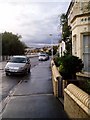
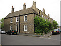
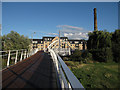
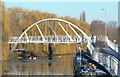
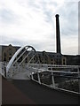
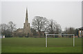
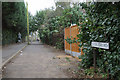
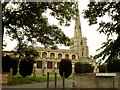
Photos of CB5 8HP


Area Information
CB5 8HP is a small, densely populated residential area in Cambridge, England, covering 7,749 square metres and home to 2,182 residents. Its compact size and high population density of 281,584 people per square kilometre reflect its role as a tightly knit housing cluster. Historically, the area developed as part of Cambridge’s 20th-century expansion, with the Fen Ditton Fields estate established between 1918 and 1939. Today, it sits at the edge of the city, bordered by former railway lines and natural features like Fen Ditton Meadows. Daily life here is shaped by its proximity to Cambridge’s core, with suburban housing laid out around ring-roads and major thoroughfares like Newmarket Road. The area’s character blends post-war housing with modern infrastructure, offering a mix of convenience and community. Residents benefit from nearby transport links, including three railway stations, and a network of retail and leisure amenities. While its small size limits expansion, CB5 8HP remains a practical choice for those seeking affordability and connectivity within Cambridge’s growing urban framework.
- Area Type
- Postcode
- Area Size
- 7749 m²
- Population
- 2182
- Population Density
- 5166 people/km²
CB5 8HP’s property market is defined by a 44% home ownership rate, with houses forming the predominant accommodation type. This suggests a mix of owner-occupied homes and rental properties, though the exact proportion of rentals is not specified. The area’s small size and historical development as a housing estate mean its stock is likely to include post-war and mid-century homes, potentially offering characterful but modest properties. As a small postcode cluster, the market may be limited in scale, with limited scope for new builds given the high population density. Buyers should consider the area’s proximity to Cambridge’s amenities, which may offset its compact footprint. However, the lack of detailed data on property prices or availability means the market’s dynamics remain opaque. For those seeking a quiet residential area with access to city services, CB5 8HP could appeal, though its limited size may restrict options for larger families or those requiring more space.
House Prices in CB5 8HP
Showing 41 properties
| Address | Type | Beds | Baths | Last Sale Price | Last Sale Date | |
|---|---|---|---|---|---|---|
| 53 River Lane, Cambridge, CB5 8HP | Terraced | 2 | 1 | £455,000 | Feb 2025 | |
| 55 River Lane, Cambridge, CB5 8HP | Terraced | 2 | 1 | £519,000 | Jun 2024 | |
| 69 River Lane, Cambridge, CB5 8HP | Terraced | 3 | 1 | £550,000 | Aug 2023 | |
| 77 River Lane, Cambridge, CB5 8HP | Terraced | 4 | 1 | £622,053 | Apr 2023 | |
| 61 River Lane, Cambridge, CB5 8HP | Terraced | 3 | 1 | £540,000 | Sep 2021 | |
| 39 River Lane, Cambridge, CB5 8HP | Terraced | 3 | 2 | £360,000 | Jun 2021 | |
| 65 River Lane, Cambridge, CB5 8HP | Terraced | 2 | 1 | £435,000 | Sep 2020 | |
| 35 River Lane, Cambridge, CB5 8HP | Terraced | 3 | 1 | £392,297 | Feb 2020 | |
| 41 River Lane, Cambridge, CB5 8HP | Terraced | 2 | 1 | £360,000 | Oct 2015 | |
| 51 River Lane, Cambridge, CB5 8HP | house | 2 | 2 | £375,000 | Aug 2015 |
Energy Efficiency in CB5 8HP
Living in CB5 8HP offers access to a range of practical amenities within reach. Retail options include major supermarkets like Tesco Cambridge, Lidl Cambridge, and Aldi Newmarket, ensuring everyday shopping needs are met. The area is served by three railway stations—Cambridge North, Shelford, and Waterbeach—providing direct links to Cambridge and surrounding towns. Two airports, both named Cambridge Airport, are nearby, though their specific roles are not detailed. The presence of Newmarket Road, a major east-west route, enhances connectivity to the city. For leisure, the historical context of the area includes Abbey Meadows School, built in the 1950s, and suburban housing layouts around ring-roads. While green spaces are not explicitly mentioned, the proximity to Fen Ditton Meadows suggests some natural areas for recreation. The lifestyle here balances suburban convenience with access to urban services, though the area’s compact size means residents must venture further for more extensive amenities.
Amenities
Schools
| Rank | School | Type | Entry gender | Ages |
|---|
Explore more schools in this area
Go to Schools tabDemographics
The population of CB5 8HP is predominantly adults aged 30–64, with a median age of 47. This suggests a mature, settled community, likely centred on families and professionals. Home ownership rates stand at 44%, indicating a mix of owner-occupied and rental properties, though the data does not specify the latter. The area’s accommodation is primarily houses, reflecting a residential profile distinct from high-density flats. The predominant ethnic group is White, with no data provided on other demographics. The high population density, combined with a median age skewed towards middle years, implies a community focused on stability rather than transient populations. This profile may influence local services and amenities, which cater to adult needs rather than those of children or elderly residents. The lack of specific data on deprivation or income levels means the area’s quality of life remains partially unquantified, though the presence of retail and transport links suggests reasonable access to essentials.
Household Size
Accommodation Type
Tenure
Ethnic Group
Religion
Household Composition
Age
Household Deprivation
NS-SEC
Explore more demographic insights in this area
Go to Demographics tabPlanning
Planning Constraints
- Flood RiskPremium
- Ramsar Wetland SitesPremium
- Area of Outstanding Natural BeautyPremium
- Protected Nature ReservePremium
- Protected WoodlandPremium