Area Overview for CB22 4NE
Photos of CB22 4NE
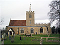
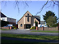
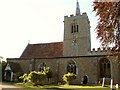
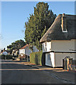
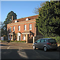
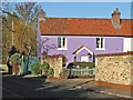
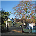
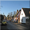
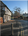
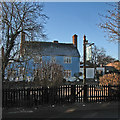
100 photos from this area
Area Information
Key information about the CB22 4NE including its size, population, and administrative classification.
- Area Type
- Postcode
- Area Size
- 25.6 hectares
- Population
- 1237
- Population Density
- 396 people/km²
House Prices in CB22 4NE
30
Properties
£308,075
Average Sold Price
£33,480
Lowest Price
£670,000
Highest Price
Showing 30 properties
| Address | Type | Beds | Baths | Last Sale Price | Last Sale Date | |
|---|---|---|---|---|---|---|
| 44 Mill Lane, Whittlesford, CB22 4NE | Semi-detached | 5 | 2 | £670,000 | Aug 2023 | |
| 34 Mill Lane, Whittlesford, CB22 4NE | house | 4 | - | £595,000 | Dec 2022 | |
| 22 Mill Lane, Whittlesford, CB22 4NE | Semi-detached | 3 | 1 | £510,000 | Feb 2021 | |
| RIVERSIDE COTTAGE, MILL LANE, Whittlesford, CB22 4NE | Detached | - | - | £267,500 | Nov 2020 | |
| 6 Mill Lane, Whittlesford, CB22 4NE | Semi-detached | 3 | 1 | £355,000 | Jun 2018 | |
| 16 Mill Lane, Whittlesford, CB22 4NE | Semi-detached | 3 | 1 | £422,000 | Jan 2017 | |
| 32 Mill Lane, Whittlesford, CB22 4NE | house | 3 | - | £285,000 | Aug 2013 | |
| 26 Mill Lane, Whittlesford, CB22 4NE | Semi-detached | - | - | £195,000 | Jun 2011 | |
| 20 Mill Lane, Whittlesford, CB22 4NE | Semi-detached | 4 | - | £192,000 | Jun 2006 | |
| 24 Mill Lane, Whittlesford, CB22 4NE | Semi-detached | - | - | £165,000 | Sep 2002 |
Page 1 of 3
Energy Efficiency in CB22 4NE
Amenities
Schools
| Rank | School | Type | Entry gender | Ages |
|---|
Explore more schools in this area
Go to Schools tabDemographics
Household Size
Two person
most common
Accommodation Type
Houses
most common
Tenure
73
majority
Ethnic Group
White
most common
Religion
N/A
most common
Household Composition
N/A
most common
Age
47
median
Adults (30-64 years)
most common
Household Deprivation
N/A
with no deprivation
NS-SEC
54
in Lower managerial occupations
Explore more demographic insights in this area
Go to Demographics tabPlanning
Planning Constraints
- Flood RiskPremium
- Ramsar Wetland SitesPremium
- Area of Outstanding Natural BeautyPremium
- Protected Nature ReservePremium
- Protected WoodlandPremium