Area Overview for CB11 3YL
Photos of CB11 3YL
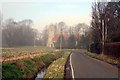
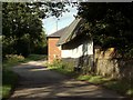
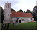
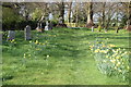
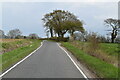
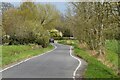
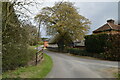
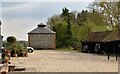
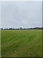
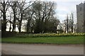
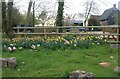
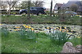
60 photos from this area
Area Information
Key information about the CB11 3YL including its size, population, and administrative classification.
- Area Type
- Postcode
- Area Size
- 2.5 km²
- Population
- 2073
- Population Density
- 93 people/km²
House Prices in CB11 3YL
16
Properties
-
Average Sold Price
-
Lowest Price
-
Highest Price
Showing 16 properties
| Address | Type | Beds | Baths | Last Sale Price | Last Sale Date | |
|---|---|---|---|---|---|---|
| Walnut Tree Cottage, Church End, Rickling Church Lane, Rickling, CB11 3YL | Detached | 3 | 2 | - | - | |
| Appletree Cottage, Church End, Rickling Church Lane, Rickling, CB11 3YL | Detached | 4 | 2 | - | - | |
| Orchard Farm, Church End, Rickling Church Lane, Rickling, CB11 3YL | Detached | 5 | 4 | - | - | |
| Mobile Home Coldhams, Church End, Rickling Church Lane, Rickling, CB11 3YL | Mobile Home | - | - | - | - | |
| Moat Farm, Church End, Rickling Church Lane, Rickling, CB11 3YL | Detached | - | - | - | - | |
| Pebbles Barn, Church End, Rickling, CB11 3YL | Bungalow | - | - | - | - | |
| Ricula Barn, Church End, Rickling Church Lane, Rickling, CB11 3YL | house | - | - | - | - | |
| Sarsen Barn, Church End, Rickling Church Lane, Rickling, CB11 3YL | house | - | - | - | - | |
| Meadow Barn, Church End, Rickling, CB11 3YL | Detached | - | - | - | - | |
| The Old Vicarage, Church End, Rickling Church Lane, Rickling, CB11 3YL | house | - | - | - | - |
Page 1 of 2
Energy Efficiency in CB11 3YL
Amenities
Schools
| Rank | School | Type | Entry gender | Ages |
|---|
Explore more schools in this area
Go to Schools tabDemographics
Household Size
Family (3-5 people)
most common
Accommodation Type
Houses
most common
Tenure
79
majority
Ethnic Group
White
most common
Religion
N/A
most common
Household Composition
N/A
most common
Age
47
median
Adults (30-64 years)
most common
Household Deprivation
N/A
with no deprivation
NS-SEC
49
in Lower managerial occupations
Explore more demographic insights in this area
Go to Demographics tabPlanning
Planning Constraints
- Flood RiskPremium
- Ramsar Wetland SitesPremium
- Area of Outstanding Natural BeautyPremium
- Protected Nature ReservePremium
- Protected WoodlandPremium