Area Overview for CB11 3UG
Photos of CB11 3UG
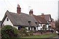
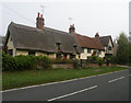
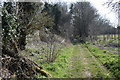
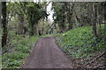
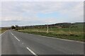
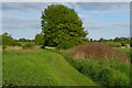

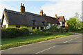

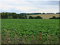
13 photos from this area
Area Information
Key information about the CB11 3UG including its size, population, and administrative classification.
- Area Type
- Postcode
- Area Size
- 2.1 km²
- Population
- 1574
- Population Density
- 83 people/km²
House Prices in CB11 3UG
58
Properties
£636,577
Average Sold Price
£155,000
Lowest Price
£1,700,000
Highest Price
Showing 58 properties
| Address | Type | Beds | Baths | Last Sale Price | Last Sale Date | |
|---|---|---|---|---|---|---|
| Wicken Lodge, Wicken Road, Wicken Bonhunt, CB11 3UG | house | 6 | 3 | £1,170,000 | Feb 2025 | |
| Rectory Stables, Wicken Road, Wicken Bonhunt, CB11 3UG | house | - | - | £1,700,000 | Jul 2022 | |
| Primrose Cottage, Wicken Road, Wicken Bonhunt, CB11 3UG | Semi-detached | 3 | 1 | £412,500 | Jun 2021 | |
| Windlebrook House, Wicken Road, Wicken Bonhunt, CB11 3UG | house | 5 | - | £930,000 | May 2021 | |
| 2 Rectory Cottage, Wicken Road, Wicken Bonhunt, CB11 3UG | house | - | - | £791,000 | Mar 2021 | |
| Laurel Cottage, Wicken Road, Wicken Bonhunt, CB11 3UG | Semi-detached | 3 | 1 | £475,000 | May 2019 | |
| Clarks Cottage, Wicken Road, Wicken Bonhunt, CB11 3UG | Detached | 4 | - | £485,000 | Aug 2017 | |
| Church Cottage, Wicken Road, Wicken Bonhunt, CB11 3UG | Semi-detached | - | - | £790,000 | Oct 2016 | |
| Rectory Cottage, Wicken Road, Wicken Bonhunt, CB11 3UG | house | 5 | - | £860,000 | Jun 2016 | |
| The Willows, Wicken Road, Wicken Bonhunt, CB11 3UG | Detached | 4 | - | £615,000 | Sep 2015 |
Page 1 of 6
Energy Efficiency in CB11 3UG
Amenities
Schools
| Rank | School | Type | Entry gender | Ages |
|---|
Explore more schools in this area
Go to Schools tabDemographics
Household Size
Two person
most common
Accommodation Type
Houses
most common
Tenure
82
majority
Ethnic Group
White
most common
Religion
N/A
most common
Household Composition
N/A
most common
Age
47
median
Adults (30-64 years)
most common
Household Deprivation
N/A
with no deprivation
NS-SEC
47
in Lower managerial occupations
Explore more demographic insights in this area
Go to Demographics tabPlanning
Planning Constraints
- Flood RiskPremium
- Ramsar Wetland SitesPremium
- Area of Outstanding Natural BeautyPremium
- Protected Nature ReservePremium
- Protected WoodlandPremium