Area Overview for CB11 3SP
Photos of CB11 3SP
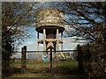
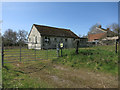
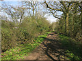
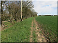
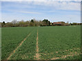
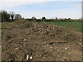

20 photos from this area
Area Information
Key information about the CB11 3SP including its size, population, and administrative classification.
- Area Type
- Postcode
- Area Size
- 91.9 hectares
- Population
- 2073
- Population Density
- 93 people/km²
House Prices in CB11 3SP
42
Properties
£803,600
Average Sold Price
£273,000
Lowest Price
£1,900,000
Highest Price
Showing 42 properties
| Address | Type | Beds | Baths | Last Sale Price | Last Sale Date | |
|---|---|---|---|---|---|---|
| The Dells, Cornells Lane, Widdington, CB11 3SP | Detached | - | - | £1,200,000 | Jun 2025 | |
| Cornells, Cornells Lane, Widdington, CB11 3SP | Detached | 2 | 1 | £1,400,000 | Jul 2023 | |
| The Weft House, Cornells Lane, Widdington, CB11 3SP | Detached | 8 | 4 | £1,900,000 | Mar 2021 | |
| Nutwood Cottage, Cornells Lane, Widdington, CB11 3SP | Semi-detached | 4 | 2 | £485,000 | Oct 2017 | |
| Blackthorn Lodge, Cornells Lane, Widdington, CB11 3SP | Detached | 4 | 2 | £650,000 | Oct 2015 | |
| The White Cottage, Cornells Lane, Widdington, CB11 3SP | Semi-detached | 4 | 2 | £436,000 | Aug 2012 | |
| William The Conqueror, Cornells Lane, Widdington, CB11 3SP | house | 4 | - | £600,000 | Apr 2011 | |
| Leylands, Cornells Lane, Widdington, CB11 3SP | house | 5 | 4 | £1,125,000 | Sep 2010 | |
| Leycot, Cornells Lane, Widdington, CB11 3SP | house | 5 | - | £690,000 | Aug 2009 | |
| Malt Place, Cornells Lane, Widdington, CB11 3SP | undefined | - | - | £495,000 | Aug 2008 |
Page 1 of 5
Energy Efficiency in CB11 3SP
Amenities
Schools
| Rank | School | Type | Entry gender | Ages |
|---|
Explore more schools in this area
Go to Schools tabDemographics
Household Size
Family (3-5 people)
most common
Accommodation Type
Houses
most common
Tenure
79
majority
Ethnic Group
White
most common
Religion
N/A
most common
Household Composition
N/A
most common
Age
47
median
Adults (30-64 years)
most common
Household Deprivation
N/A
with no deprivation
NS-SEC
49
in Lower managerial occupations
Explore more demographic insights in this area
Go to Demographics tabPlanning
Planning Constraints
- Flood RiskPremium
- Ramsar Wetland SitesPremium
- Area of Outstanding Natural BeautyPremium
- Protected Nature ReservePremium
- Protected WoodlandPremium