Area Overview for CB10 2TF
Photos of CB10 2TF
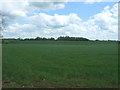
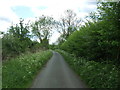
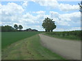
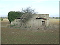
8 photos from this area
Area Information
Key information about the CB10 2TF including its size, population, and administrative classification.
- Area Type
- Postcode
- Area Size
- 2.9 km²
- Population
- 1939
- Population Density
- 39 people/km²
House Prices in CB10 2TF
29
Properties
£911,111
Average Sold Price
£200,000
Lowest Price
£1,275,000
Highest Price
Showing 29 properties
| Address | Type | Beds | Baths | Last Sale Price | Last Sale Date | |
|---|---|---|---|---|---|---|
| Little Brockholds, Roman Road, Radwinter, CB10 2TF | house | - | - | £1,000,000 | Aug 2023 | |
| Lime Barn, Roman Road, Radwinter, CB10 2TF | house | - | - | £1,240,000 | Aug 2023 | |
| The Meads, Roman Road, Radwinter, CB10 2TF | Detached | 4 | 5 | £665,000 | Dec 2022 | |
| The Haven, Roman Road, Radwinter, CB10 2TF | house | - | - | £1,160,000 | Dec 2022 | |
| Jenkinhogs Farm, Roman Road, Radwinter, CB10 2TF | Semi-detached | 4 | 1 | £315,000 | May 2021 | |
| Minerva House, Roman Road, Radwinter, CB10 2TF | Detached | 5 | 3 | £1,275,000 | Feb 2021 | |
| Tresilian House, Roman Road, Radwinter, CB10 2TF | Detached | 5 | 3 | £1,070,000 | Dec 2016 | |
| Radwinter House, Roman Road, Radwinter, CB10 2TF | house | 5 | 4 | £1,275,000 | Apr 2012 | |
| Springfield, Roman Road, Radwinter, CB10 2TF | Land | - | - | £200,000 | Sep 1998 | |
| Rowans, Roman Road, Radwinter, CB10 2TF | Detached | 4 | 3 | - | - |
Page 1 of 3
Energy Efficiency in CB10 2TF
Amenities
Schools
| Rank | School | Type | Entry gender | Ages |
|---|
Explore more schools in this area
Go to Schools tabDemographics
Household Size
Two person
most common
Accommodation Type
Houses
most common
Tenure
79
majority
Ethnic Group
White
most common
Religion
N/A
most common
Household Composition
N/A
most common
Age
47
median
Adults (30-64 years)
most common
Household Deprivation
N/A
with no deprivation
NS-SEC
45
in Lower managerial occupations
Explore more demographic insights in this area
Go to Demographics tabPlanning
Planning Constraints
- Flood RiskPremium
- Ramsar Wetland SitesPremium
- Area of Outstanding Natural BeautyPremium
- Protected Nature ReservePremium
- Protected WoodlandPremium