Area Overview for CB10 2HH
Photos of CB10 2HH
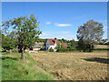

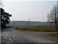
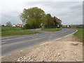
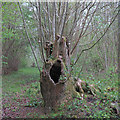

27 photos from this area
Area Information
Key information about the CB10 2HH including its size, population, and administrative classification.
- Area Type
- Postcode
- Area Size
- 2.8 hectares
- Population
- 1749
- Population Density
- 55 people/km²
House Prices in CB10 2HH
35
Properties
£240,727
Average Sold Price
£164,000
Lowest Price
£315,000
Highest Price
Showing 35 properties
| Address | Type | Beds | Baths | Last Sale Price | Last Sale Date | |
|---|---|---|---|---|---|---|
| 32 Guildhall Way, Ashdon, CB10 2HH | Semi-detached | 2 | 1 | £315,000 | Jun 2023 | |
| 22 Guildhall Way, Ashdon, CB10 2HH | Terraced | 3 | 1 | £300,000 | Jun 2019 | |
| 29 Guildhall Way, Ashdon, CB10 2HH | Terraced | 3 | - | £270,000 | Jun 2016 | |
| 28 Guildhall Way, Ashdon, CB10 2HH | Terraced | 3 | - | £265,000 | Jun 2015 | |
| 11 Guildhall Way, Ashdon, CB10 2HH | house | 3 | - | £164,000 | Feb 2012 | |
| 21 Guildhall Way, Ashdon, CB10 2HH | house | - | - | £208,000 | Sep 2011 | |
| 30 Guildhall Way, Ashdon, CB10 2HH | house | 3 | - | £215,000 | Mar 2011 | |
| 5 Guildhall Way, Ashdon, CB10 2HH | Semi-detached | 3 | 1 | £240,000 | Mar 2010 | |
| 1 Guildhall Way, Ashdon, CB10 2HH | house | - | - | £241,000 | Sep 2007 | |
| 25 Guildhall Way, Ashdon, CB10 2HH | house | - | - | £245,000 | Jul 2007 |
Page 1 of 4
Energy Efficiency in CB10 2HH
Amenities
Schools
| Rank | School | Type | Entry gender | Ages |
|---|
Explore more schools in this area
Go to Schools tabDemographics
Household Size
Two person
most common
Accommodation Type
Houses
most common
Tenure
79
majority
Ethnic Group
White
most common
Religion
N/A
most common
Household Composition
N/A
most common
Age
47
median
Adults (30-64 years)
most common
Household Deprivation
N/A
with no deprivation
NS-SEC
47
in Lower managerial occupations
Explore more demographic insights in this area
Go to Demographics tabPlanning
Planning Constraints
- Flood RiskPremium
- Ramsar Wetland SitesPremium
- Area of Outstanding Natural BeautyPremium
- Protected Nature ReservePremium
- Protected WoodlandPremium