Area Overview for Great Wilbraham
Photos of Great Wilbraham


Area Information
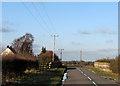
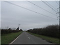
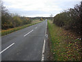
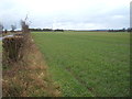
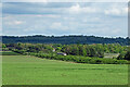
Great Wilbraham is a civil parish located in Cambridgeshire, covering an area of 11.8 km² within the fenland region of East Anglia. This settlement possesses deep historical roots, having existed for thousands of years. Archaeological excavations uncovered a Neolithic camp in the west of the parish in 1976. A Bronze Age barrow with up to eight burials also surfaced in the southern corner in 1852 alongside the Fleam Dyke. The name itself derives from the Homestead of a woman called Wilburh, appearing as *Wilburgeham* in the 10th century and *Wiborgham* in the Domesday Book of 1086. The area was first distinguished as Great Wilbraham in the 13th century. Its population is approximately 1,037 residents. Daily life here is characterised by a quiet, rural atmosphere shaped by its agricultural setting. The village features medieval origins, most notably through the Church of Saint Nicholas. This building dates from the 12th century and includes a west tower constructed around 1400. Ancient religious history is evident in the church, which held Templar tombstones and cross markers. A preceptory established by the Knights Templar in 1226 later passed to the Knights Hospitallers by 1313. The present church structure received major renovations between 1878 and 1893. Beyond the spiritual landmarks, a Baptist chapel survives at the north end of Angle End, reflecting the village's history as a centre of religious dissent in the 17th century. Living in Great Wilbraham offers buyers a connection to this tangible past.
- Area Type
- Parish
- Area Size
- 11.8 km²
- Population
- Not available
- Population Density
- Not available
Demographics
Living in Great Wilbraham means residing in a community with a distinctly older demographic profile. The median age stands at 70 years. This figure places the village significantly higher than national averages for age. Records identify the total age range as the most common classification within the dataset provided. The population structure suggests a steady presence of elderly residents who contribute to a slower pace of life. House ownership figures reveal that 70% of residents own their homes. This high rate of home ownership indicates a settled population with deep roots in the parish. The remaining 30% reside in rental accommodation. Diversity metrics within the provided data do not specify ethnic breakdowns or religious affiliations in detail. The dataset lists total household composition and total accommodation types as the primary categories. These broad classifications reflect the village's nature as a small, traditional settlement rather than a diverse metropolitan district. The absence of granular diversity data highlights a homogenous community structure typical of rural Cambridgeshire parishes. Deprivation levels are not explicitly detailed in the available figures. However, the low population count of 1,037 respondents suggests limited economic stratification compared to larger towns. Residents benefit from the stability associated with a predominantly owner-occupied stock. The community feels cohesive and established. Homebuyers should expect a demographic environment defined by longevity and historical continuity rather than rapid turnover. The area supports those seeking a retirement destination or a permanent home away from city noise.
Household Size
Accommodation Type
Tenure
Ethnic Group
Religion
Household Composition
Age
Household Deprivation
NS-SEC
Explore more demographic insights in this area
Go to Demographics tabPlanning
Planning Constraints
- Flood RiskPremium
- Ramsar Wetland SitesPremium
- Area of Outstanding Natural BeautyPremium
- Protected Nature ReservePremium
- Protected WoodlandPremium