Area Overview for Peterborough
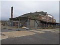
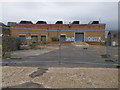
Photos of Peterborough


Area Information
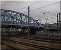
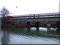
Peterborough is a built-up area in England covering 47.8 km², home to 43,328 residents. Its population density of 906 people per square kilometre reflects a compact, urbanised environment with a mix of residential and commercial spaces. The town balances historical character with modern infrastructure, offering a range of amenities within practical reach. With broadband scores of 97 and mobile coverage of 85, residents enjoy reliable digital connectivity, supporting both remote work and daily internet use. Nearby schools, including Old Fletton Primary School and Southfields Primary School, both rated ‘good’ by Ofsted, cater to families. Peterborough’s transport links are robust, with two railway stations and four metro stops, including Ferry Meadows and Orton Mere, ensuring easy access to surrounding areas. The area’s appeal lies in its accessibility, community-focused amenities, and the blend of urban convenience with green spaces, making it a viable choice for those seeking a balanced lifestyle.
- Area Type
- Built Up Area 250
- Area Size
- 47.8 km²
- Population
- 43328
- Population Density
- 906 people/km²
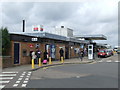
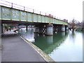
Peterborough’s residents have access to a range of amenities, including five retail outlets such as Co-op Peterborough, Co-op Mayors, and Waitrose Peterborough, ensuring convenient shopping. The town’s rail and metro networks, including Peterborough Railway Station, connect to nearby areas, enhancing accessibility. Parks and leisure spots like Ferry Meadows and Orton Mere offer recreational opportunities. The blend of retail, transport, and green spaces contributes to a functional, community-oriented lifestyle. While the data does not specify dining or cultural venues, the proximity to these amenities suggests a practical, well-served environment for daily living.
Amenities
Schools
Peterborough’s schools include Caverstede Nursery School, The Pupil Referral Service, Old Fletton Primary School, Southfields Primary School, and Woodston Primary School. Of these, Old Fletton and Southfields are rated ‘good’ by Ofsted, offering families a reliable educational option. The presence of a nursery school and a pupil referral service highlights the area’s commitment to supporting diverse educational needs, from early years to specialist provision. While the data does not include secondary schools, the mix of primary and nursery institutions suggests a focus on foundational education. Families should verify specific school catchment areas and Ofsted reports for detailed insights, as the overall quality of education in Peterborough appears to be a key consideration for residents.
| Rank | School | Type | Entry gender | Ages |
|---|
Explore more schools in this area
Go to Schools tabDemographics
Peterborough’s population has a median age of 70, the highest in the dataset, suggesting a community skewed towards older residents. Home ownership stands at 56%, indicating a mix of owner-occupied and rental properties. The data does not specify household composition or accommodation types, but the overall profile points to a settled, possibly retired demographic. The area’s population density of 906 people per km² implies a compact living environment, which may influence local services and social dynamics. While no detailed breakdown of ethnic groups or religions is provided, the figures suggest a homogeneous community. The high median age may affect local amenities and healthcare provision, though specific data on deprivation or socioeconomic factors is absent.