Area Overview for Broadland District
Photos of Broadland District

Area Information
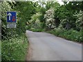
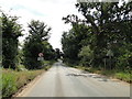
Living in Broadland District offers a distinctly rural experience within Norfolk, England. This local authority district covers a significant area of 553.0 km² and sits to the north and east of Norwich, which serves as its administrative centre. The landscape is defined by rich arable land and the unique aquatic scenery of the Norfolk Broads inland waterway system. Much of the valley floor has been embanked and drained for agricultural use, shaping the daily life of residents who interact closely with this distinctive environment. The area retains a historic character dating back to the Anglo-Saxon kingdom of East Anglia, with Viking settlement influences visible in place-names like those ending in "-by" across locations such as Flegg. Today, the community maintains a deep connection to this heritage, evidenced by a historical density of parish churches established during the Domesday survey of 1086. Visiting Norwich provides easy access to administrative and cultural facilities, yet life in Broadland itself revolves around the tranquil pace of the countryside. You will find yourself navigating a setting where the administrative town anchors the district, but the daily reality unfolds across vast tracts of farmland and wetlands. This location suits those who value proximity to agricultural roots and waterways while retaining connection to a larger urban centre through the administrative hub of Norwich.
- Area Type
- District/Borough
- Area Size
- 553.0 km²
- Population
- Not available
- Population Density
- Not available
Demographics
The community in Broadland District reflects a mature demographic profile characterised by a median age of 70 years. This indicates a population dominated by older residents, likely those seeking retirement in the rural Norfolk countryside or individuals with significant remaining years in their lives. Approximately 78% of homes here are owner-occupied, suggesting a stable community where families and individuals have established long-term roots over generations. This high level of home ownership contrasts with areas dependent on temporary rental markets, implying residents are less likely to move frequently. While specific data on household composition, predominant ethnic groups, and religious affiliations are not detailed in current records, the age profile strongly suggests a predominantly settled population. The absence of young families in the available statistics points to a neighbourhood primarily suited to retirees rather than working-age parents looking for proximity to elementary schools or kindergarten facilities. If you are considering moving here, the social environment will centre on established local networks rather than transient populations. The demographic makeup confirms Broadland District functions primarily as a retirement destination rather than a young professionals' hub or a family-oriented suburb.
Household Size
Accommodation Type
Tenure
Ethnic Group
Religion
Household Composition
Age
Household Deprivation
NS-SEC
Explore more demographic insights in this area
Go to Demographics tabPlanning
Planning Constraints
- Flood RiskPremium
- Ramsar Wetland SitesPremium
- Area of Outstanding Natural BeautyPremium
- Protected Nature ReservePremium
- Protected WoodlandPremium