Area Overview for AL9 7RU
Photos of AL9 7RU
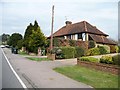
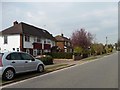
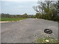
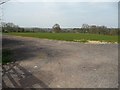

24 photos from this area
Area Information
Key information about the AL9 7RU including its size, population, and administrative classification.
- Area Type
- Postcode
- Area Size
- 7.0 hectares
- Population
- 1324
- Population Density
- 481 people/km²
House Prices in AL9 7RU
34
Properties
£758,804
Average Sold Price
£207,000
Lowest Price
£1,495,000
Highest Price
Showing 34 properties
| Address | Type | Beds | Baths | Last Sale Price | Last Sale Date | |
|---|---|---|---|---|---|---|
| 28 Moffats Lane, Brookmans Park, AL9 7RU | house | 4 | 2 | £1,250,000 | Nov 2023 | |
| 46A Moffats Lane, Brookmans Park, AL9 7RU | Detached | 4 | 2 | £1,450,000 | Apr 2023 | |
| 2 Moffats Lane, Brookmans Park, AL9 7RU | Semi-detached | 4 | 3 | £1,167,500 | Dec 2022 | |
| 14 Moffats Lane, Brookmans Park, AL9 7RU | Detached | 4 | 1 | £960,000 | May 2021 | |
| 30 Moffats Lane, Brookmans Park, AL9 7RU | house | - | - | £1,495,000 | Feb 2021 | |
| 18 Moffats Lane, Brookmans Park, AL9 7RU | Detached | 3 | 2 | £870,000 | Jul 2020 | |
| 32 Moffats Lane, Brookmans Park, AL9 7RU | Detached | 4 | 1 | £1,170,000 | Apr 2019 | |
| 58 Moffats Lane, Brookmans Park, AL9 7RU | Detached | 3 | 2 | £515,000 | Jun 2017 | |
| 46 Moffats Lane, Brookmans Park, AL9 7RU | Detached | 4 | 2 | £970,000 | May 2016 | |
| 52 Moffats Lane, Brookmans Park, AL9 7RU | house | - | - | £1,000,000 | Jan 2012 |
Page 1 of 4
Energy Efficiency in AL9 7RU
Amenities
Schools
| Rank | School | Type | Entry gender | Ages |
|---|
Explore more schools in this area
Go to Schools tabDemographics
Household Size
Family (3-5 people)
most common
Accommodation Type
Houses
most common
Tenure
91
majority
Ethnic Group
White
most common
Religion
N/A
most common
Household Composition
N/A
most common
Age
47
median
Adults (30-64 years)
most common
Household Deprivation
N/A
with no deprivation
NS-SEC
50
in Lower managerial occupations
Explore more demographic insights in this area
Go to Demographics tabPlanning
Planning Constraints
- Flood RiskPremium
- Ramsar Wetland SitesPremium
- Area of Outstanding Natural BeautyPremium
- Protected Nature ReservePremium
- Protected WoodlandPremium