Area Overview for AL9 7RT
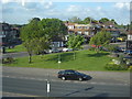
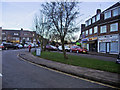
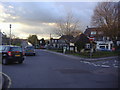
Photos of AL9 7RT
![Construction site, Brookmans Avenue [1] in AL9 7RT](https://images.propbar.co.uk/images/geograph/44/31/4431297_120.jpg)


35 photos from this area
Area Information
Key information about the AL9 7RT including its size, population, and administrative classification.
- Area Type
- Postcode
- Area Size
- 1.7 hectares
- Population
- 1324
- Population Density
- 481 people/km²
House Prices in AL9 7RT
21
Properties
£742,643
Average Sold Price
£495,000
Lowest Price
£1,100,000
Highest Price
Showing 21 properties
| Address | Type | Beds | Baths | Last Sale Price | Last Sale Date | |
|---|---|---|---|---|---|---|
| 67 Moffats Lane, Brookmans Park, AL9 7RT | Detached | 4 | 2 | £880,000 | Jan 2024 | |
| 59 Moffats Lane, Brookmans Park, AL9 7RT | Bungalow | 3 | 3 | £1,100,000 | Jun 2021 | |
| 55A Moffats Lane, Brookmans Park, AL9 7RT | Semi-detached | 3 | 2 | £865,000 | Jun 2021 | |
| 55 Moffats Lane, Brookmans Park, AL9 7RT | Semi-detached | 4 | 1 | £790,000 | Mar 2018 | |
| 63 Moffats Lane, Brookmans Park, AL9 7RT | Detached | - | - | £696,000 | May 2017 | |
| 61 Moffats Lane, Brookmans Park, AL9 7RT | Bungalow | 3 | - | £700,000 | Nov 2015 | |
| 51 Moffats Lane, Brookmans Park, AL9 7RT | Detached | 4 | 3 | £743,500 | Oct 2015 | |
| 91 Moffats Lane, Brookmans Park, AL9 7RT | Detached | 3 | 1 | £740,000 | Nov 2014 | |
| 57 Moffats Lane, Brookmans Park, AL9 7RT | Bungalow | 4 | 2 | £730,000 | Oct 2014 | |
| 83 Moffats Lane, Brookmans Park, AL9 7RT | Semi-detached | 4 | - | £650,000 | Aug 2014 |
Page 1 of 3
Energy Efficiency in AL9 7RT
Amenities
Schools
| Rank | School | Type | Entry gender | Ages |
|---|
Explore more schools in this area
Go to Schools tabDemographics
Household Size
Family (3-5 people)
most common
Accommodation Type
Houses
most common
Tenure
91
majority
Ethnic Group
White
most common
Religion
N/A
most common
Household Composition
N/A
most common
Age
47
median
Adults (30-64 years)
most common
Household Deprivation
N/A
with no deprivation
NS-SEC
50
in Lower managerial occupations
Explore more demographic insights in this area
Go to Demographics tabPlanning
Planning Constraints
- Flood RiskPremium
- Ramsar Wetland SitesPremium
- Area of Outstanding Natural BeautyPremium
- Protected Nature ReservePremium
- Protected WoodlandPremium