Area Overview for AL6 9PW
Photos of AL6 9PW


Area Information
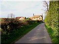
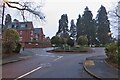
Living in AL6 9PW offers a quiet, residential experience in a small cluster of homes within Hertfordshire’s Welwyn area. With a population of 1,451 spread across 3,417 square metres, the community feels intimate, with a population density of 178 people per square kilometre. This postcode sits in a historic part of Welwyn, a village with roots as a Roman posting station and later a key stop on the Great North Road. Its proximity to Welwyn Garden City, established in 1920, adds a layer of modernity to its traditional character. Daily life here is defined by low traffic, a slower pace, and access to nearby amenities. The area’s small size means a tight-knit community, where residents often know their neighbours. While it lacks the density of larger towns, its charm lies in its simplicity—think rural tranquillity with practical connectivity. For those seeking a peaceful base near Hertfordshire’s historic routes, AL6 9PW balances heritage with modern convenience.
- Area Type
- Postcode
- Area Size
- 3417 m²
- Population
- 1451
- Population Density
- 178 people/km²
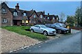
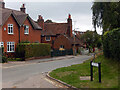
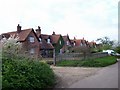
AL6 9PW is primarily an owner-occupied area, with 72% of homes owned by residents rather than rented. The accommodation type is predominantly houses, which is typical for smaller, rural postcode areas. This suggests a market characterised by single-family homes, likely with gardens and more space than the flats or apartments found in urban centres. The low population density of 178 people per square kilometre reinforces this pattern, as there is little demand for high-density housing. For buyers, this means a limited but stable market, where properties are likely to be long-term investments rather than short-term rentals. The small size of the area also means that the housing stock is not extensive, so opportunities for purchase may be limited to specific locations within the postcode. Those seeking a home here should consider the appeal of private, low-maintenance living, though the lack of high-rise development may not suit those needing more compact or urban options.
House Prices in AL6 9PW
No properties found in this postcode.
Energy Efficiency in AL6 9PW
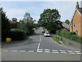
Residents of AL6 9PW have access to a range of nearby amenities, including five retail outlets such as Tesco Welwyn, M&S Nodeway BP, and Co-op Knightsfield. These shops provide essentials, making daily errands convenient without the need to travel far. The area’s proximity to railway stations—Welwyn North, Welwyn Garden City, and Knebworth—offers easy access to public transport, connecting residents to broader Hertfordshire and London. While the postcode itself is small, its integration with Welwyn Garden City adds cultural and recreational opportunities. The presence of multiple retail points and transport links suggests a lifestyle that balances local convenience with regional connectivity. The area’s low population density means fewer crowds, but the availability of shops and rail services ensures that residents are not cut off from essential services. This combination of practical amenities and transport options supports a lifestyle that is both self-contained and linked to larger networks.
Amenities
Schools
| Rank | School | Type | Entry gender | Ages |
|---|
Explore more schools in this area
Go to Schools tabDemographics
The residents of AL6 9PW are predominantly adults aged 30–64, with a median age of 47. This suggests a mature, stable community with a strong presence of working-age individuals and families. Home ownership is high, at 72%, with most properties being houses rather than flats or apartments. The predominant ethnic group is White, reflecting the area’s historical and demographic continuity. The population density of 178 people per square kilometre indicates a low-rise, spread-out settlement, which aligns with the predominance of single-family homes. This configuration supports a quieter, more private lifestyle, though it may limit the diversity of local services compared to larger urban areas. The age profile suggests a community focused on long-term stability, with fewer young families or retirees than might be found in other postcode areas.
Household Size
Accommodation Type
Tenure
Ethnic Group
Religion
Household Composition
Age
Household Deprivation
NS-SEC
Explore more demographic insights in this area
Go to Demographics tabPlanning
Planning Constraints
- Flood RiskPremium
- Ramsar Wetland SitesPremium
- Area of Outstanding Natural BeautyPremium
- Protected Nature ReservePremium
- Protected WoodlandPremium