Area Overview for AL6 9PT
Photos of AL6 9PT


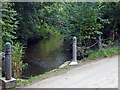
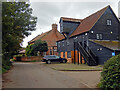
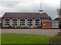

23 photos from this area
Area Information
Key information about the AL6 9PT including its size, population, and administrative classification.
- Area Type
- Postcode
- Area Size
- 4.8 hectares
- Population
- 1451
- Population Density
- 178 people/km²
House Prices in AL6 9PT
33
Properties
£399,681
Average Sold Price
£95,000
Lowest Price
£600,000
Highest Price
Showing 33 properties
| Address | Type | Beds | Baths | Last Sale Price | Last Sale Date | |
|---|---|---|---|---|---|---|
| 17 Wilga Road, Welwyn, AL6 9PT | Semi-detached | 3 | 1 | £600,000 | Dec 2024 | |
| 13 Wilga Road, Welwyn, AL6 9PT | Semi-detached | 4 | 2 | £590,000 | Aug 2024 | |
| 27 Wilga Road, Welwyn, AL6 9PT | Terraced | 4 | 1 | £595,000 | May 2024 | |
| 39 Wilga Road, Welwyn, AL6 9PT | house | 4 | - | £525,000 | Jun 2021 | |
| 9 Wilga Road, Welwyn, AL6 9PT | Semi-detached | 3 | 1 | £463,000 | May 2020 | |
| 35 Wilga Road, Welwyn, AL6 9PT | house | - | - | £455,000 | Jun 2019 | |
| 45 Wilga Road, Welwyn, AL6 9PT | house | - | - | £511,500 | Dec 2018 | |
| 33 Wilga Road, Welwyn, AL6 9PT | house | - | - | £402,130 | Nov 2018 | |
| 55 Wilga Road, Welwyn, AL6 9PT | house | - | - | £487,000 | Oct 2018 | |
| 53 Wilga Road, Welwyn, AL6 9PT | house | 3 | 1 | £449,950 | Aug 2017 |
Page 1 of 4
Energy Efficiency in AL6 9PT
Amenities
Schools
| Rank | School | Type | Entry gender | Ages |
|---|
Explore more schools in this area
Go to Schools tabDemographics
Household Size
Two person
most common
Accommodation Type
Houses
most common
Tenure
72
majority
Ethnic Group
White
most common
Religion
N/A
most common
Household Composition
N/A
most common
Age
47
median
Adults (30-64 years)
most common
Household Deprivation
N/A
with no deprivation
NS-SEC
51
in Lower managerial occupations
Explore more demographic insights in this area
Go to Demographics tabPlanning
Planning Constraints
- Flood RiskPremium
- Ramsar Wetland SitesPremium
- Area of Outstanding Natural BeautyPremium
- Protected Nature ReservePremium
- Protected WoodlandPremium