Area Overview for AL4 0XP
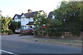
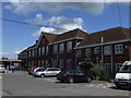
Photos of AL4 0XP


Area Information
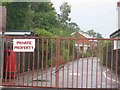
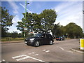
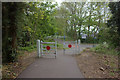
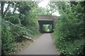
Hill End represents a distinct residential cluster on the outskirts of St Albans, defined by its specific postcode range and rich local history. The area encompasses roughly 7718 square metres and houses a population of 1909 people. This specific locale is historically significant, having been shaped by the neighbouring Hill End Hospital, which operated as a major mental health facility from 1899 until 1995. The hospital once expanded across approximately 589 acres, creating a self-sufficient estate that influenced the surrounding landscape. Today, the character of this small area is marked by large gardens and wide roads that adjoined the former Great Northern railway line. You can still trace the path of this former transport link today along the Alban Way. Living here means residing in a quiet environment that retains the footprint of its past while serving as a practical commuter hub near St Albans City. The proximity to rail stations makes daily travel feasible, yet the immediate surroundings offer a sense of separation from the town centre. This postcode covers a tight-knit community where the historical legacy of George Thomas Hine's asylum design subtly influences the modern street pattern.
- Area Type
- Postcode
- Area Size
- 7718 m²
- Population
- 1909
- Population Density
- 6542 people/km²
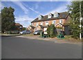
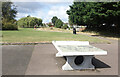
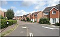
The housing stock in AL4 0XP is dominated by owner-occupied homes. With 79 per cent of residents owning their property, this is not a rental hotspot but a place for people to settle permanently. The accommodation type reflects this reality; houses form the main housing stock. You are unlikely to find modern eco-flats or creative micro-apartments here. Instead, the physical footprint of the area, covering 7718 square metres for nearly 2000 people, implies spacious residential clusters rather than dense urban blocks. The history of the area, once anchored by the massive Hill End Hospital estate, likely influenced the scale of these home sizes. Buyers looking for properties here will find a market where sellers have held onto their homes for extended periods. The low population density of 247340 people per square kilometre figure, while numerically high due to the small unit of measurement, effectively signals a low-density, spacious living arrangement. This type of market suits those who value garden space and个人隐私. Historical context from the County Asylum era may mean some local land is still used as open green space or large residential plots. Potential buyers should appreciate that this is a traditional gentleman's estate area turned residential.
House Prices in AL4 0XP
Showing 32 properties
| Address | Type | Beds | Baths | Last Sale Price | Last Sale Date | |
|---|---|---|---|---|---|---|
| 427 Hatfield Road, St Albans, AL4 0XP | Semi-detached | 3 | 1 | £455,000 | Nov 2025 | |
| 439 Hatfield Road, St Albans, AL4 0XP | Semi-detached | 3 | 1 | £700,000 | Jul 2023 | |
| 419 Hatfield Road, St Albans, AL4 0XP | Retail | 4 | 1 | £485,000 | Apr 2022 | |
| 425 Hatfield Road, St Albans, AL4 0XP | Semi-detached | 3 | 1 | £534,000 | Feb 2022 | |
| 421 Hatfield Road, St Albans, AL4 0XP | house | - | - | £485,000 | Sep 2021 | |
| 415A Hatfield Road, St Albans, AL4 0XP | Flat | - | - | £5,000 | Mar 2018 | |
| 435 Hatfield Road, St Albans, AL4 0XP | Semi-detached | 3 | 1 | £490,000 | Dec 2017 | |
| 411A Hatfield Road, St Albans, AL4 0XP | Flat | - | - | £198,000 | Jan 2015 | |
| 405A Hatfield Road, St Albans, AL4 0XP | Flat | 2 | 1 | £159,950 | Jan 2014 | |
| 429 Hatfield Road, St Albans, AL4 0XP | Semi-detached | 3 | 1 | £280,000 | Mar 2012 |
Energy Efficiency in AL4 0XP
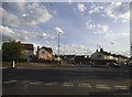
Amenities are concentrated within practical reach of AL4 0XP residents, ensuring convenience without requiring daily travel. Retail options include Spar, Spar, and Morrisons Fleetville, offering basic daily necessities and groceries. You will find five retail venues nearby, providing sufficient choice for weekly shopping needs. Rail connectivity is equally well served with five stations within easy reach, including St Albans City Railway Station and Park Street Railway Station. This abundance of transport nodes ensures you can reach your destination quickly. The area's lifestyle is largely residential, supplemented by these essential services. While the data does not list cinema or nightlife venues, the close proximity to St Albans means you do not need these local amenities for weekend entertainment. The notable feature of the area includes the legacy of Hill End Hospital, which now forms part of the landscape. Walking along the former rail line path offers a quiet retreat. The availability of Spar stores means you can pick up essentials with minimal effort. Residents enjoy a self-contained daily life where food, transport, and basic services are all accessible immediately.
Amenities
Schools
Education provision for families near AL4 0XP is supported by two institutions close by: Beaumont School. Statistics show one entry as a primary academy and another as a standalone primary school. The academy variant holds an Ofsted rating of outstanding, which is the highest possible grade for educational quality. This rating indicates that the institution meets exceptional standards in teaching and student outcomes. Living in AL4 0XP ensures that children have access to this specific educational establishment without needing to travel far to St Albans city centre. The coexistence of primary and academy designations suggests a structured approach to early education in the region. You do not need to look beyond this immediate radius for your youngest children's schooling needs. The outstanding rating of the academy provides a strong foundation for early learning. While the data does not list secondary options, the presence of a primary school with top-tier performance is a significant asset. Parents value this specific beacon of educational quality. For a small area with 1909 residents, having access to nationally outstanding educational resources is a practical advantage. The school types cater specifically to early years and primary age groups, matching the adult demographic of the local population.
| Rank | School | Type | Entry gender | Ages |
|---|
Explore more schools in this area
Go to Schools tabDemographics
The community in AL4 0XP reflects a mature demographic profile, with a median age of 47 years. Residents are predominantly found within the adult age bracket, mostly falling between 30 and 64 years old. This is an established neighbourhood rather than a family-first zone for younger parents, suggesting a population looking for stability and long-term residence. Home ownership stands at 79 per cent, indicating that the area is overwhelmingly geared towards residents who have purchased their properties rather than those in the rental sector. The primary accommodation type consists of houses, which provides significant independence compared to flat living. The predominant ethnic group is White, creating a culturally specific environment. You will find a stable population that has chosen to put down roots in Hertfordshire. The high rate of home ownership suggests residents are invested in the long-term value of their homes in AL4 0XP. This demographic makes sense given the large sizes of the houses and the older, established nature of the streets. The area is practical for those who have already accumulated wealth and are seeking a low-maintenance lifestyle.
Household Size
Accommodation Type
Tenure
Ethnic Group
Religion
Household Composition
Age
Household Deprivation
NS-SEC
Explore more demographic insights in this area
Go to Demographics tabPlanning
Planning Constraints
- Flood RiskPremium
- Ramsar Wetland SitesPremium
- Area of Outstanding Natural BeautyPremium
- Protected Nature ReservePremium
- Protected WoodlandPremium