Area Overview for AL10 9LP
Photos of AL10 9LP
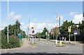
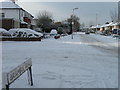
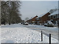
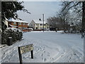
19 photos from this area
Area Information
Key information about the AL10 9LP including its size, population, and administrative classification.
- Area Type
- Postcode
- Area Size
- 5673 m²
- Population
- 2247
- Population Density
- 1811 people/km²
House Prices in AL10 9LP
8
Properties
£440,907
Average Sold Price
£375,000
Lowest Price
£629,950
Highest Price
Showing 8 properties
| Address | Type | Beds | Baths | Last Sale Price | Last Sale Date | |
|---|---|---|---|---|---|---|
| 2 Cunningham Avenue, Hatfield, AL10 9LP | Detached | 5 | 4 | £629,950 | Jun 2022 | |
| 3 Cunningham Avenue, Hatfield, AL10 9LP | house | - | - | £375,000 | Jun 2014 | |
| 4 Cunningham Avenue, Hatfield, AL10 9LP | house | 6 | - | £380,000 | Sep 2012 | |
| 5 Cunningham Avenue, Hatfield, AL10 9LP | Detached | 6 | 4 | £385,000 | Jun 2008 | |
| 1 Cunningham Avenue, Hatfield, AL10 9LP | house | - | - | £396,500 | Mar 2007 | |
| 8 Cunningham Avenue, Hatfield, AL10 9LP | Detached | 6 | 4 | £479,950 | Jun 2006 | |
| 6 Cunningham Avenue, Hatfield, AL10 9LP | house | - | - | £439,950 | Jun 2006 | |
| 7 Cunningham Avenue, Hatfield, AL10 9LP | house | - | - | - | - |
Energy Efficiency in AL10 9LP
Amenities
Schools
| Rank | School | Type | Entry gender | Ages |
|---|
Explore more schools in this area
Go to Schools tabDemographics
Household Size
Family (3-5 people)
most common
Accommodation Type
Houses
most common
Tenure
31
majority
Ethnic Group
White
most common
Religion
N/A
most common
Household Composition
N/A
most common
Age
22
median
Young Adults (15-29 years)
most common
Household Deprivation
N/A
with no deprivation
NS-SEC
22
in Lower managerial occupations
Explore more demographic insights in this area
Go to Demographics tabPlanning
Planning Constraints
- Flood RiskPremium
- Ramsar Wetland SitesPremium
- Area of Outstanding Natural BeautyPremium
- Protected Nature ReservePremium
- Protected WoodlandPremium