Area Overview for AL10 9AA
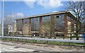
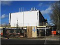
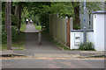
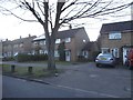
Photos of AL10 9AA


Area Information
Living in AL10 9AA means being part of a compact, residential cluster in England’s Hertfordshire region. The area spans 6 hectares and is home to 2,390 people, making it a densely populated yet manageable community. With a median age of 22, it is a young area, dominated by individuals aged 15–29. This demographic suggests a mix of students, early-career professionals, and families seeking affordability. The high home ownership rate (76%) and prevalence of houses indicate a stable, settled community. Proximity to Hatfield Railway Station and nearby retail hubs like Tesco Hatfield and Morrisons Daily ensures practical connectivity. The area’s low crime risk and absence of environmental constraints like protected woodlands or Areas of Outstanding Natural Beauty make it appealing for those prioritising safety and ease of living. While small, AL10 9AA offers a balance of residential tranquillity and access to urban amenities, ideal for those seeking a base in a growing part of Hertfordshire.
- Area Type
- Postcode
- Area Size
- 6.0 hectares
- Population
- 2390
- Population Density
- 1912 people/km²
AL10 9AA is primarily an owner-occupied area, with 76% of homes owned by residents rather than rented. The accommodation type is predominantly houses, which contrasts with areas where flats or apartments dominate. This suggests a housing stock suited to families or individuals seeking more space, though the small area size (6 hectares) implies limited property diversity. The high home ownership rate may indicate long-term residency and stability, but it also means the market could be less dynamic for renters. Buyers should consider that the area’s compact nature may restrict access to larger properties or newer developments. Proximity to Hatfield’s rail network and retail amenities may enhance the appeal of homes here, particularly for those prioritising convenience over expansive living spaces. The lack of listed rental properties or specific property types (e.g., terraced houses, detached homes) means further research into local listings would be necessary for a full picture of the market.
House Prices in AL10 9AA
No properties found in this postcode.
Energy Efficiency in AL10 9AA
AL10 9AA offers practical access to retail and transport hubs. Nearby shops include Morrisons Daily, Tesco Hatfield, and Co-op Bishops, providing everyday essentials within reach. The rail network, with stations like Hatfield and Welham Green, connects residents to broader Hertfordshire and London. While the data does not list parks or leisure facilities, the proximity to Hatfield—a town known for its parks and cultural amenities—may offer additional recreational opportunities. The compact nature of the area means residents can walk or cycle to local amenities, fostering a sense of convenience. However, the absence of named parks or leisure venues in the data means lifestyle options beyond retail and transport are not detailed. The balance of retail accessibility and transport links makes daily life in AL10 9AA efficient, though further exploration of nearby towns would be needed for a full lifestyle picture.
Amenities
Schools
The nearest educational institution to AL10 9AA is the University of Hertfordshire, categorised as an “other” type in the data. This suggests the area is close to higher education facilities but does not include primary or secondary schools. Families with children requiring schooling at these levels would need to look beyond AL10 9AA, potentially commuting to Hatfield or nearby towns. The absence of listed schools in the data means it is unclear whether the area supports a full range of educational options. For those prioritising proximity to universities, the University of Hertfordshire’s presence may be a draw, but it does not address the needs of younger children. Prospective buyers with school-age dependents should investigate nearby districts for comprehensive educational infrastructure.
| Rank | School | Type | Entry gender | Ages |
|---|
Explore more schools in this area
Go to Schools tabDemographics
AL10 9AA has a median age of 22, with the majority of residents aged 15–29. This young demographic shapes the area’s character, suggesting a focus on education, employment, and family formation. Home ownership is high at 76%, with most properties being houses rather than flats, indicating a preference for family-friendly housing. The predominant ethnic group is White, reflecting the broader demographic trends in Hertfordshire. The population density of 1,912 people per square kilometre is notably high, which, combined with the young age profile, may point to a community with active social and economic engagement. However, the data does not indicate levels of deprivation or income distribution, so it is unclear how this affects quality of life. The absence of significant diversity metrics means the area’s social fabric is largely defined by its young, predominantly White, and owner-occupied population.
Household Size
Accommodation Type
Tenure
Ethnic Group
Religion
Household Composition
Age
Household Deprivation
NS-SEC
Explore more demographic insights in this area
Go to Demographics tabPlanning
Planning Constraints
- Flood RiskPremium
- Ramsar Wetland SitesPremium
- Area of Outstanding Natural BeautyPremium
- Protected Nature ReservePremium
- Protected WoodlandPremium