Area Overview for AL10 0HF
Photos of AL10 0HF
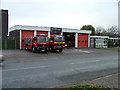
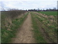
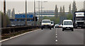
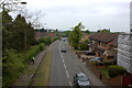
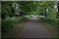
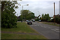
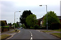
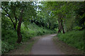
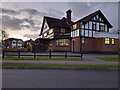
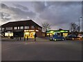
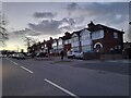
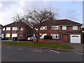
34 photos from this area
Area Information
Key information about the AL10 0HF including its size, population, and administrative classification.
- Area Type
- Postcode
- Area Size
- 1.8 hectares
- Population
- 1675
- Population Density
- 6834 people/km²
House Prices in AL10 0HF
36
Properties
£338,226
Average Sold Price
£81,000
Lowest Price
£768,000
Highest Price
Showing 36 properties
| Address | Type | Beds | Baths | Last Sale Price | Last Sale Date | |
|---|---|---|---|---|---|---|
| 10 Cecil Crescent, Hatfield, AL10 0HF | house | 3 | 1 | £442,500 | Aug 2025 | |
| 4 Cecil Crescent, Hatfield, AL10 0HF | Semi-detached | 3 | 1 | £480,000 | Sep 2024 | |
| The Grange, Cecil Crescent, Hatfield, AL10 0HF | Detached | 4 | 3 | £768,000 | Feb 2024 | |
| Four Winds, Cecil Crescent, Hatfield, AL10 0HF | Bungalow | 4 | 1 | £380,000 | Sep 2021 | |
| 3 Cecil Crescent, Hatfield, AL10 0HF | Semi-detached | 3 | 2 | £405,000 | Nov 2019 | |
| 22 Cecil Crescent, Hatfield, AL10 0HF | Semi-detached | 4 | 2 | £492,450 | Oct 2019 | |
| 25 Cecil Crescent, Hatfield, AL10 0HF | Terraced | 3 | 1 | £390,000 | Feb 2018 | |
| 17 Cecil Crescent, Hatfield, AL10 0HF | house | - | - | £382,000 | Jan 2016 | |
| 12 Cecil Crescent, Hatfield, AL10 0HF | house | - | - | £365,000 | Aug 2014 | |
| 20A Cecil Crescent, Hatfield, AL10 0HF | Semi-detached | 4 | 2 | £230,000 | Mar 2012 |
Page 1 of 4
Energy Efficiency in AL10 0HF
Amenities
Schools
| Rank | School | Type | Entry gender | Ages |
|---|
Explore more schools in this area
Go to Schools tabDemographics
Household Size
Family (3-5 people)
most common
Accommodation Type
Houses
most common
Tenure
40
majority
Ethnic Group
White
most common
Religion
N/A
most common
Household Composition
N/A
most common
Age
47
median
Adults (30-64 years)
most common
Household Deprivation
N/A
with no deprivation
NS-SEC
29
in Lower managerial occupations
Explore more demographic insights in this area
Go to Demographics tabPlanning
Planning Constraints
- Flood RiskPremium
- Ramsar Wetland SitesPremium
- Area of Outstanding Natural BeautyPremium
- Protected Nature ReservePremium
- Protected WoodlandPremium