Area Overview for AL1 4UN
Photos of AL1 4UN
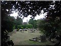
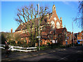
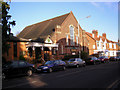
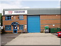


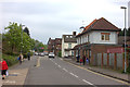
59 photos from this area
Area Information
Key information about the AL1 4UN including its size, population, and administrative classification.
- Area Type
- Postcode
- Area Size
- 1.3 hectares
- Population
- 1762
- Population Density
- 5597 people/km²
House Prices in AL1 4UN
72
Properties
£406,094
Average Sold Price
£72,500
Lowest Price
£765,000
Highest Price
Showing 72 properties
| Address | Type | Beds | Baths | Last Sale Price | Last Sale Date | |
|---|---|---|---|---|---|---|
| 314 Hatfield Road, St Albans, AL1 4UN | Detached | 3 | 2 | £765,000 | Dec 2024 | |
| 268 Hatfield Road, St Albans, AL1 4UN | Semi-detached | 7 | 3 | £540,000 | Nov 2022 | |
| 308 Hatfield Road, St Albans, AL1 4UN | house | 3 | 1 | £675,000 | Aug 2022 | |
| 284 Hatfield Road, St Albans, AL1 4UN | house | 3 | 2 | £730,000 | Jun 2021 | |
| 248 Hatfield Road, St Albans, AL1 4UN | Semi-detached | 3 | 2 | £565,000 | Jul 2016 | |
| 258A Hatfield Road, St Albans, AL1 4UN | Maisonette | 1 | - | £163,000 | Jan 2016 | |
| 274 Hatfield Road, St Albans, AL1 4UN | Semi-detached | 5 | 2 | £402,500 | Jul 2013 | |
| 282 Hatfield Road, St Albans, AL1 4UN | Detached | 11 | 6 | £530,000 | May 2013 | |
| 300 Hatfield Road, St Albans, AL1 4UN | Semi-detached | 3 | 1 | £364,000 | Aug 2012 | |
| 276 Hatfield Road, St Albans, AL1 4UN | Semi-detached | - | - | £357,500 | Jun 2012 |
Page 1 of 8
Energy Efficiency in AL1 4UN
Amenities
Schools
| Rank | School | Type | Entry gender | Ages |
|---|
Explore more schools in this area
Go to Schools tabDemographics
Household Size
Family (3-5 people)
most common
Accommodation Type
Houses
most common
Tenure
74
majority
Ethnic Group
White
most common
Religion
N/A
most common
Household Composition
N/A
most common
Age
47
median
Adults (30-64 years)
most common
Household Deprivation
N/A
with no deprivation
NS-SEC
55
in Lower managerial occupations
Explore more demographic insights in this area
Go to Demographics tabPlanning
Planning Constraints
- Flood RiskPremium
- Ramsar Wetland SitesPremium
- Area of Outstanding Natural BeautyPremium
- Protected Nature ReservePremium
- Protected WoodlandPremium