Area Overview for AL1 4SF
Photos of AL1 4SF
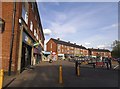
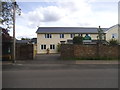
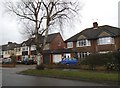
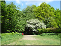
31 photos from this area
Area Information
Key information about the AL1 4SF including its size, population, and administrative classification.
- Area Type
- Postcode
- Area Size
- 1.2 hectares
- Population
- 1786
- Population Density
- 2554 people/km²
House Prices in AL1 4SF
20
Properties
£915,113
Average Sold Price
£190,000
Lowest Price
£1,710,000
Highest Price
Showing 20 properties
| Address | Type | Beds | Baths | Last Sale Price | Last Sale Date | |
|---|---|---|---|---|---|---|
| 79 Charmouth Road, St Albans, AL1 4SF | Detached | 4 | 4 | £1,600,000 | Apr 2023 | |
| 95 Charmouth Road, St Albans, AL1 4SF | Detached | 4 | - | £1,710,000 | Aug 2022 | |
| 67 Charmouth Road, St Albans, AL1 4SF | Retail | 4 | 2 | £1,410,000 | Jul 2022 | |
| 85 Charmouth Road, St Albans, AL1 4SF | house | - | - | £1,003,350 | Mar 2021 | |
| 83 Charmouth Road, St Albans, AL1 4SF | house | - | - | £1,200,000 | Nov 2018 | |
| 101 Charmouth Road, St Albans, AL1 4SF | house | - | - | £1,325,000 | Sep 2018 | |
| 97 Charmouth Road, St Albans, AL1 4SF | house | - | - | £935,000 | Dec 2016 | |
| 99 Charmouth Road, St Albans, AL1 4SF | Detached | 3 | 3 | £950,000 | Feb 2016 | |
| 81 Charmouth Road, St Albans, AL1 4SF | Detached | 5 | 3 | £635,000 | Sep 2011 | |
| 63 Charmouth Road, St Albans, AL1 4SF | Detached | 3 | 3 | £478,125 | Jun 2009 |
Page 1 of 2
Energy Efficiency in AL1 4SF
Amenities
Schools
| Rank | School | Type | Entry gender | Ages |
|---|
Explore more schools in this area
Go to Schools tabDemographics
Household Size
Family (3-5 people)
most common
Accommodation Type
Houses
most common
Tenure
91
majority
Ethnic Group
White
most common
Religion
N/A
most common
Household Composition
N/A
most common
Age
47
median
Adults (30-64 years)
most common
Household Deprivation
N/A
with no deprivation
NS-SEC
64
in Lower managerial occupations
Explore more demographic insights in this area
Go to Demographics tabPlanning
Planning Constraints
- Flood RiskPremium
- Ramsar Wetland SitesPremium
- Area of Outstanding Natural BeautyPremium
- Protected Nature ReservePremium
- Protected WoodlandPremium