Area Overview for SK13 7BT
Photos of SK13 7BT
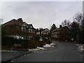
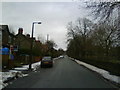
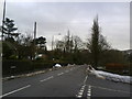
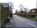
100 photos from this area
Area Information
Key information about the SK13 7BT including its size, population, and administrative classification.
- Area Type
- Postcode
- Area Size
- 1.5 hectares
- Population
- 2161
- Population Density
- 1004 people/km²
House Prices in SK13 7BT
19
Properties
£235,613
Average Sold Price
£49,950
Lowest Price
£600,500
Highest Price
Showing 19 properties
| Address | Type | Beds | Baths | Last Sale Price | Last Sale Date | |
|---|---|---|---|---|---|---|
| 26, Spire Hollin House, Spire Hollin, Glossop, SK13 7BT | house | - | - | £350,000 | Jun 2021 | |
| 13 Spire Hollin, Glossop, SK13 7BT | house | - | - | £305,000 | Jun 2021 | |
| 11 Spire Hollin, Glossop, SK13 7BT | house | - | - | £340,000 | May 2021 | |
| 18A Spire Hollin, Glossop, SK13 7BT | Detached | 4 | 2 | £600,500 | Mar 2021 | |
| 36 Spire Hollin, Glossop, SK13 7BT | Semi-detached | 3 | 1 | £285,000 | Feb 2021 | |
| 32 Spire Hollin, Glossop, SK13 7BT | house | - | - | £222,500 | Apr 2016 | |
| 9 Spire Hollin, Glossop, SK13 7BT | house | - | - | £155,000 | Aug 2015 | |
| 5 Spire Hollin, Glossop, SK13 7BT | Terraced | - | - | £111,000 | Mar 2012 | |
| 28, Spire Hollin House, Spire Hollin, Glossop, SK13 7BT | house | 3 | - | £193,000 | Mar 2011 | |
| 17 Spire Hollin, Glossop, SK13 7BT | Terraced | - | - | £135,450 | Jun 2003 |
Page 1 of 2
Energy Efficiency in SK13 7BT
Amenities
Schools
| Rank | School | Type | Entry gender | Ages |
|---|
Explore more schools in this area
Go to Schools tabDemographics
Household Size
Two person
most common
Accommodation Type
Houses
most common
Tenure
90
majority
Ethnic Group
White
most common
Religion
N/A
most common
Household Composition
N/A
most common
Age
47
median
Adults (30-64 years)
most common
Household Deprivation
N/A
with no deprivation
NS-SEC
52
in Lower managerial occupations
Explore more demographic insights in this area
Go to Demographics tabPlanning
Planning Constraints
- Flood RiskPremium
- Ramsar Wetland SitesPremium
- Area of Outstanding Natural BeautyPremium
- Protected Nature ReservePremium
- Protected WoodlandPremium