Area Overview for S45 0BA
Photos of S45 0BA
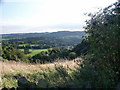
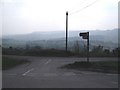
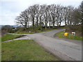
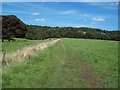
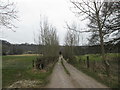
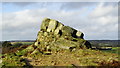
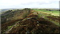
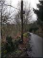
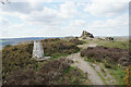
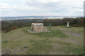
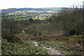
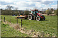
65 photos from this area
Area Information
Key information about the S45 0BA including its size, population, and administrative classification.
- Area Type
- Postcode
- Area Size
- 34.7 hectares
- Population
- 1959
- Population Density
- 51 people/km²
House Prices in S45 0BA
12
Properties
£547,195
Average Sold Price
£275,000
Lowest Price
£953,976
Highest Price
Showing 12 properties
| Address | Type | Beds | Baths | Last Sale Price | Last Sale Date | |
|---|---|---|---|---|---|---|
| Beechfield House, Milken Lane, Far Hill, Ashover, S45 0BA | Cottage | 3 | 2 | £462,000 | Mar 2024 | |
| Eastwood Lodge, Milken Lane, Far Hill, Ashover, S45 0BA | Detached | - | - | £953,976 | Jul 2021 | |
| Eastwood View, Milken Lane, Far Hill, Ashover, S45 0BA | Detached | 6 | 2 | £705,000 | Apr 2017 | |
| Grange Farm, Milken Lane, Far Hill, Ashover, S45 0BA | Detached | - | - | £340,000 | Feb 2008 | |
| Park View Cottage, Milken Lane, Far Hill, Ashover, S45 0BA | house | - | - | £275,000 | Aug 2005 | |
| Hazeldene, Milken Lane, Far Hill, Ashover, S45 0BA | Land | 4 | 2 | - | - | |
| The Old Barn, Milken Lane, Far Hill, Ashover, S45 0BA | Detached | 4 | - | - | - | |
| Annexe, Grange Barn, Milken Lane, Far Hill, Ashover, S45 0BA | Flat | 4 | - | - | - | |
| Grange Barn, Milken Lane, Far Hill, Ashover, S45 0BA | Detached | - | - | - | - | |
| Tennis 38M From Ashover Parish Hall, Far Hill 36M From Milken Lane, Milken Lane, Far Hill, Ashover, S45 0BA | Leisure | - | - | - | - |
Page 1 of 2
Energy Efficiency in S45 0BA
Amenities
Schools
| Rank | School | Type | Entry gender | Ages |
|---|
Explore more schools in this area
Go to Schools tabDemographics
Household Size
Two person
most common
Accommodation Type
Houses
most common
Tenure
79
majority
Ethnic Group
White
most common
Religion
N/A
most common
Household Composition
N/A
most common
Age
47
median
Adults (30-64 years)
most common
Household Deprivation
N/A
with no deprivation
NS-SEC
41
in Lower managerial occupations
Explore more demographic insights in this area
Go to Demographics tabPlanning
Planning Constraints
- Flood RiskPremium
- Ramsar Wetland SitesPremium
- Area of Outstanding Natural BeautyPremium
- Protected Nature ReservePremium
- Protected WoodlandPremium