Area Overview for S45 0AL
Photos of S45 0AL
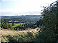
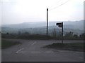
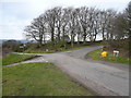
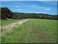
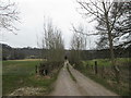
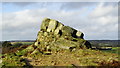
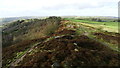
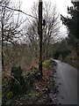
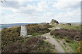
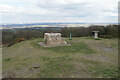
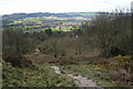
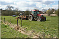
65 photos from this area
Area Information
Key information about the S45 0AL including its size, population, and administrative classification.
- Area Type
- Postcode
- Area Size
- 4.3 hectares
- Population
- 1959
- Population Density
- 51 people/km²
House Prices in S45 0AL
51
Properties
£177,297
Average Sold Price
£20,799
Lowest Price
£385,000
Highest Price
Showing 51 properties
| Address | Type | Beds | Baths | Last Sale Price | Last Sale Date | |
|---|---|---|---|---|---|---|
| 12 Malthouse Lane, Ashover, S45 0AL | Semi-detached | 2 | 1 | £230,000 | Aug 2024 | |
| 28 Malthouse Lane, Ashover, S45 0AL | Semi-detached | 3 | 1 | £260,000 | Aug 2024 | |
| 52 Malthouse Lane, Ashover, S45 0AL | Semi-detached | 5 | 3 | £385,000 | Apr 2024 | |
| 38 Malthouse Lane, Ashover, S45 0AL | Semi-detached | 3 | - | £237,000 | May 2019 | |
| 32 Malthouse Lane, Ashover, S45 0AL | Semi-detached | 3 | 1 | £201,000 | Nov 2018 | |
| 42 Malthouse Lane, Ashover, S45 0AL | Semi-detached | 3 | 1 | £210,000 | Oct 2017 | |
| 62 Malthouse Lane, Ashover, S45 0AL | Semi-detached | 3 | - | £130,000 | Oct 2015 | |
| Beechcroft, 4 Malthouse Lane, Ashover, S45 0AL | Bungalow | 3 | - | £315,000 | Jul 2014 | |
| 50 Malthouse Lane, Ashover, S45 0AL | Semi-detached | 3 | 1 | £210,000 | Nov 2013 | |
| 40 Malthouse Lane, Ashover, S45 0AL | Semi-detached | 3 | 1 | £155,000 | Aug 2009 |
Page 1 of 6
Energy Efficiency in S45 0AL
Amenities
Schools
| Rank | School | Type | Entry gender | Ages |
|---|
Explore more schools in this area
Go to Schools tabDemographics
Household Size
Two person
most common
Accommodation Type
Houses
most common
Tenure
79
majority
Ethnic Group
White
most common
Religion
N/A
most common
Household Composition
N/A
most common
Age
47
median
Adults (30-64 years)
most common
Household Deprivation
N/A
with no deprivation
NS-SEC
41
in Lower managerial occupations
Explore more demographic insights in this area
Go to Demographics tabPlanning
Planning Constraints
- Flood RiskPremium
- Ramsar Wetland SitesPremium
- Area of Outstanding Natural BeautyPremium
- Protected Nature ReservePremium
- Protected WoodlandPremium