Area Overview for S44 6UG
Photos of S44 6UG
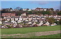
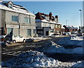
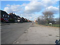
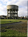
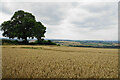
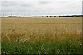
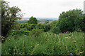
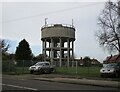
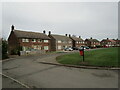
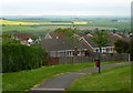
27 photos from this area
Area Information
Key information about the S44 6UG including its size, population, and administrative classification.
- Area Type
- Postcode
- Area Size
- 10.4 hectares
- Population
- 1311
- Population Density
- 243 people/km²
House Prices in S44 6UG
29
Properties
£138,731
Average Sold Price
£59,500
Lowest Price
£210,000
Highest Price
Showing 29 properties
| Address | Type | Beds | Baths | Last Sale Price | Last Sale Date | |
|---|---|---|---|---|---|---|
| 15 Valley Road, Bolsover, S44 6UG | Bungalow | 2 | 1 | £140,000 | Jan 2025 | |
| 1 Valley Road, Bolsover, S44 6UG | Retail | 2 | 1 | £169,000 | Mar 2022 | |
| 21 Valley Road, Bolsover, S44 6UG | Bungalow | 2 | 1 | £210,000 | Jun 2021 | |
| 9 Valley Road, Bolsover, S44 6UG | Bungalow | 3 | 1 | £170,000 | Sep 2019 | |
| 5 Valley Road, Bolsover, S44 6UG | Bungalow | 3 | 1 | £160,000 | Aug 2018 | |
| 34 Valley Road, Bolsover, S44 6UG | Bungalow | 3 | 1 | £155,000 | Apr 2017 | |
| 19 Valley Road, Bolsover, S44 6UG | Bungalow | 2 | 2 | £152,500 | Mar 2017 | |
| 30 Valley Road, Bolsover, S44 6UG | Bungalow | 3 | 1 | £157,000 | Sep 2014 | |
| 20 Valley Road, Bolsover, S44 6UG | Bungalow | 3 | - | £148,000 | Jun 2012 | |
| 28 Valley Road, Bolsover, S44 6UG | Detached | - | - | £105,000 | Jun 2004 |
Page 1 of 3
Energy Efficiency in S44 6UG
Amenities
Schools
| Rank | School | Type | Entry gender | Ages |
|---|
Explore more schools in this area
Go to Schools tabDemographics
Household Size
Two person
most common
Accommodation Type
Houses
most common
Tenure
69
majority
Ethnic Group
White
most common
Religion
N/A
most common
Household Composition
N/A
most common
Age
47
median
Adults (30-64 years)
most common
Household Deprivation
N/A
with no deprivation
NS-SEC
26
in Lower managerial occupations
Explore more demographic insights in this area
Go to Demographics tabPlanning
Planning Constraints
- Flood RiskPremium
- Ramsar Wetland SitesPremium
- Area of Outstanding Natural BeautyPremium
- Protected Nature ReservePremium
- Protected WoodlandPremium