Area Overview for S44 6BT
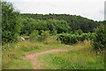
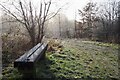
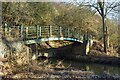
Photos of S44 6BT


Area Information
S44 6BT represents a small residential cluster covering an area of 17.4 hectares. This postcode serves 1,636 people and sits within a suburban landscape that prioritises privacy and established living environments. The population density is recorded at 112 people per square kilometre, indicating a spread-out community rather than a dense urban centre. You will find this area distinct from high-density city quarters due to its focus on detached and semi-detached housing typical of the surrounding region. Daily life here revolves around quiet neighbourhoods rather than commercial centres, though practical amenities remain within easy reach. Residents of this specific postcode benefit from a settled environment away from the immediate chaos of major transport hubs, yet still connected to wider networks. The area attracts those who value ownership, as three-quarters of households already own their homes. The demographic profile suggests a mature community where adults between the ages of 30 and 64 form the largest group. This stability creates a calm atmosphere suitable for families who have outgrown inner-city living or those seeking a permanent home without the challenges of high-density rental accommodation. Living in S44 6BT means choosing a slice of Sheffield that balances accessibility with a traditional, low-rise suburban character.
- Area Type
- Postcode
- Area Size
- 17.4 hectares
- Population
- 1636
- Population Density
- 112 people/km²
The property market in S44 6BT is characterised by a strong presence of owner-occupiers rather than landlords or tenants. With 73% of households owning their homes, this postcode functions as a classic example of an established residential zone. The overwhelming majority of the housing stock comprises houses, which aligns with the preference of the local demographic for detached or semi-detached living spaces. This divides the market away from areas where flats dominate the skyline. The high ownership figure signals that residents are typically invested in their properties and unlikely to move frequently. For buyers visiting this small 17.4-hectare cluster, the implication is a market driven by inheritance, upgrades, or first-time buyers targeting the housing ladder rather than investment portfolios. The lack of significant social or private rented housing suggests limited short-term rental activity. This stability benefits the local economy and reduces the transient nature often found in metropolitan districts. When assessing homes in S44 6BT, you should expect standardised domestic layouts rather than converted apartments or modern build complexes. The property profile here supports a traditional family life, with gardens and private outdoor space being integral to the selling points.
House Prices in S44 6BT
Showing 8 properties
| Address | Type | Beds | Baths | Last Sale Price | Last Sale Date | |
|---|---|---|---|---|---|---|
| 2, Leaholme, Chesterfield Road, Bolsover, S44 6BT | Semi-detached | 3 | 1 | £189,000 | Feb 2025 | |
| 8, Leaholme, Chesterfield Road, Bolsover, S44 6BT | house | - | - | £180,000 | Nov 2021 | |
| 6, Leaholme, Chesterfield Road, Bolsover, S44 6BT | Semi-detached | 3 | 1 | £125,000 | Mar 2015 | |
| 5, Leaholme, Chesterfield Road, Bolsover, S44 6BT | house | - | - | £100,000 | Apr 2005 | |
| 1, Leaholme, Chesterfield Road, Bolsover, S44 6BT | Semi-detached | 4 | 1 | - | - | |
| 3, Leaholme, Chesterfield Road, Bolsover, S44 6BT | Semi-detached | - | - | - | - | |
| 4, Leaholme, Chesterfield Road, Bolsover, S44 6BT | Semi-detached | - | - | - | - | |
| 7, Leaholme, Chesterfield Road, Bolsover, S44 6BT | Semi-detached | - | - | - | - |
Energy Efficiency in S44 6BT
Living in S44 6BT places you within easy reach of practical retail outlets that form the backbone of local shopping. Five notable retailers operate within practical reach, providing essential goods without requiring a long journey into city centres. You can visit Co-op Duckmanton for everyday groceries or head to Asda Markham for larger weekly shops. Those carrying specific bulk items or needing budget options can utilize Farmfoods Bolsover as an additional choice. This retail cluster ensures that daily necessities are accessible without excessive travel time or fuel costs. Transport links for leisure travel are bolstered by five nearby rail stations, granting access to Chesterfield Railway Station, Langwith, and Creswell Railway Station. These stations act as gateways to wider destinations. A coach station operates close by, offering further public transport flexibility. While there are no named parks or leisure centres listed in the immediate data, the distribution of shops and stations creates a functional lifestyle hub. The area suits those who prefer practicality over high-end entertainment venues. Shopping and transport needs are met efficiently by the named tenants and stations available near this residential cluster, ensuring a self-sufficient local environment.
Amenities
Schools
Families considering S44 6BT have direct access to Arkwright Primary School, which is situated just outside the immediate boundary of the postcode. This school is a primary institution with an Ofsted rating of satisfactory. The presence of this single named primary school defines the educational landscape for younger children within the area. There are no secondary schools listed in the immediate vicinity of S44 6BT, meaning older students must commute to locations outside this specific cluster. The school environment is characterised by this one specific educational provider for primary education. While the area does not boast a college or sixth form within its own bounds, the proximity to Arkwright ensures that elementary education is readily available. A satisfactory rating indicates that the school meets national standards for teaching and student support. This profile suits families who value a primary education close to home before potential moves to secondary schools further afield. The mix of school types here is minimal, focusing entirely on early years and primary education within the searchable radius. Prospective parents can visit Arkwright Primary School to see how it meets the needs of children in S44 6BT specifically.
| Rank | School | Type | Entry gender | Ages |
|---|
Explore more schools in this area
Go to Schools tabDemographics
The community profile of S44 6BT is defined by stability and maturity. The median age for residents is 47 years, confirming that this is not a retirement village but a family-focused area dominated by adults aged between 30 and 64 years. Home ownership stands at a strong 73%, which defines the fabric of the local neighbourhood. This high ownership rate contrasts sharply with the national average for private rented sectors. The predominant ethnic group in the area is White, reflecting the longstanding nature of the local settlement. The accommodation stock consists primarily of houses, meaning you will not find the flats or purpose-built blocks common in city centres. This housing type supports the higher home ownership percentage observed in the data. There are no large blocks of shared housing or significant bright-pipe developments. The prevailing response to purchase rather than rent indicates a desirable location for buyers who prefer the equity and security of ownership. This demographic mix suggests neighbours who are likely to be established in their homes rather than transient renters. Understanding these figures helps prospective buyers visualise a stable community where long-term residents form the backbone of local interaction and neighbourhood watch initiatives.
Household Size
Accommodation Type
Tenure
Ethnic Group
Religion
Household Composition
Age
Household Deprivation
NS-SEC
Explore more demographic insights in this area
Go to Demographics tabPlanning
Planning Constraints
- Flood RiskPremium
- Ramsar Wetland SitesPremium
- Area of Outstanding Natural BeautyPremium
- Protected Nature ReservePremium
- Protected WoodlandPremium