Area Overview for S44 5TH
Photos of S44 5TH
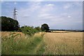
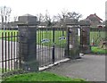
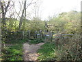

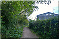
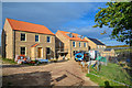
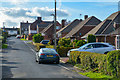
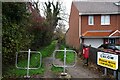
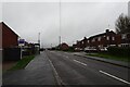
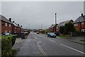
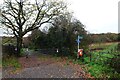
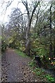
31 photos from this area
Area Information
Key information about the S44 5TH including its size, population, and administrative classification.
- Area Type
- Postcode
- Area Size
- 1.2 hectares
- Population
- 1257
- Population Density
- 329 people/km²
House Prices in S44 5TH
28
Properties
£175,948
Average Sold Price
£40,000
Lowest Price
£565,000
Highest Price
Showing 28 properties
| Address | Type | Beds | Baths | Last Sale Price | Last Sale Date | |
|---|---|---|---|---|---|---|
| 35 Rose Avenue, Calow, S44 5TH | house | - | - | £170,000 | Jun 2023 | |
| 49 Rose Avenue, Calow, S44 5TH | Semi-detached | 3 | 1 | £235,000 | Oct 2022 | |
| 42 Rose Avenue, Calow, S44 5TH | Retail | 3 | 1 | £225,000 | Jun 2022 | |
| 22 Rose Avenue, Calow, S44 5TH | Detached | 3 | - | £565,000 | Dec 2021 | |
| 36 Rose Avenue, Calow, S44 5TH | house | - | - | £240,000 | Oct 2021 | |
| 55 Rose Avenue, Calow, S44 5TH | house | - | - | £146,000 | Jan 2021 | |
| 47 Rose Avenue, Calow, S44 5TH | Semi-detached | 3 | 1 | £165,000 | Nov 2020 | |
| 33 Rose Avenue, Calow, S44 5TH | house | - | - | £186,000 | Sep 2020 | |
| 20 Rose Avenue, Calow, S44 5TH | Semi-detached | 3 | - | £155,000 | Jan 2020 | |
| 37 Rose Avenue, Calow, S44 5TH | Detached | 3 | 1 | £230,000 | Nov 2019 |
Page 1 of 3
Energy Efficiency in S44 5TH
Amenities
Schools
| Rank | School | Type | Entry gender | Ages |
|---|
Explore more schools in this area
Go to Schools tabDemographics
Household Size
Two person
most common
Accommodation Type
Houses
most common
Tenure
84
majority
Ethnic Group
White
most common
Religion
N/A
most common
Household Composition
N/A
most common
Age
47
median
Adults (30-64 years)
most common
Household Deprivation
N/A
with no deprivation
NS-SEC
32
in Lower managerial occupations
Explore more demographic insights in this area
Go to Demographics tabPlanning
Planning Constraints
- Flood RiskPremium
- Ramsar Wetland SitesPremium
- Area of Outstanding Natural BeautyPremium
- Protected Nature ReservePremium
- Protected WoodlandPremium