Area Overview for S44 5QD
Photos of S44 5QD
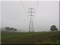
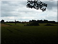
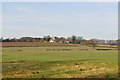
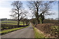
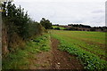
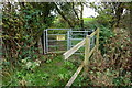
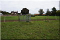
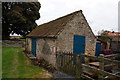
60 photos from this area
Area Information
Key information about the S44 5QD including its size, population, and administrative classification.
- Area Type
- Postcode
- Area Size
- 1.4 hectares
- Population
- 1561
- Population Density
- 498 people/km²
House Prices in S44 5QD
27
Properties
£133,818
Average Sold Price
£31,000
Lowest Price
£355,000
Highest Price
Showing 27 properties
| Address | Type | Beds | Baths | Last Sale Price | Last Sale Date | |
|---|---|---|---|---|---|---|
| 30 Rowthorne Lane, Glapwell, S44 5QD | Bungalow | 2 | 2 | £355,000 | Nov 2024 | |
| 18 Rowthorne Lane, Glapwell, S44 5QD | Bungalow | 2 | 1 | £224,000 | Dec 2023 | |
| 54 Rowthorne Lane, Glapwell, S44 5QD | Semi-detached | 4 | 2 | £140,000 | Aug 2019 | |
| 16 Rowthorne Lane, Glapwell, S44 5QD | Bungalow | 2 | 1 | £140,000 | Mar 2017 | |
| 42 Rowthorne Lane, Glapwell, S44 5QD | Bungalow | 3 | 1 | £215,000 | Mar 2016 | |
| 36 Rowthorne Lane, Glapwell, S44 5QD | Bungalow | 4 | - | £160,000 | Oct 2015 | |
| 12 Rowthorne Lane, Glapwell, S44 5QD | Bungalow | 4 | 1 | £147,500 | Mar 2015 | |
| 34 Rowthorne Lane, Glapwell, S44 5QD | Bungalow | - | - | £250,000 | Oct 2013 | |
| 28 Rowthorne Lane, Glapwell, S44 5QD | Bungalow | 2 | - | £135,000 | Jan 2011 | |
| 40 Rowthorne Lane, Glapwell, S44 5QD | Bungalow | 3 | - | £100,000 | Nov 2007 |
Page 1 of 3
Energy Efficiency in S44 5QD
Amenities
Schools
| Rank | School | Type | Entry gender | Ages |
|---|
Explore more schools in this area
Go to Schools tabDemographics
Household Size
Two person
most common
Accommodation Type
Houses
most common
Tenure
73
majority
Ethnic Group
White
most common
Religion
N/A
most common
Household Composition
N/A
most common
Age
47
median
Adults (30-64 years)
most common
Household Deprivation
N/A
with no deprivation
NS-SEC
28
in Lower managerial occupations
Explore more demographic insights in this area
Go to Demographics tabPlanning
Planning Constraints
- Flood RiskPremium
- Ramsar Wetland SitesPremium
- Area of Outstanding Natural BeautyPremium
- Protected Nature ReservePremium
- Protected WoodlandPremium