Area Overview for S44 5LU
Photos of S44 5LU
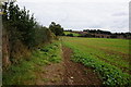
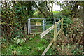
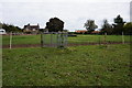
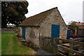
60 photos from this area
Area Information
Key information about the S44 5LU including its size, population, and administrative classification.
- Area Type
- Postcode
- Area Size
- 9.7 hectares
- Population
- 1561
- Population Density
- 498 people/km²
House Prices in S44 5LU
37
Properties
£196,294
Average Sold Price
£24,000
Lowest Price
£510,000
Highest Price
Showing 37 properties
| Address | Type | Beds | Baths | Last Sale Price | Last Sale Date | |
|---|---|---|---|---|---|---|
| 95 The Hill, Glapwell, S44 5LU | Bungalow | 4 | 2 | £325,000 | Jan 2025 | |
| Alondra, 95A The Hill, Glapwell, S44 5LU | Bungalow | 4 | 1 | £250,000 | Feb 2024 | |
| 141 The Hill, Glapwell, S44 5LU | Semi-detached | 3 | 1 | £130,000 | Jan 2023 | |
| 121 The Hill, Glapwell, S44 5LU | Detached | 4 | 2 | £510,000 | May 2022 | |
| 69 The Hill, Glapwell, S44 5LU | house | - | - | £195,000 | Feb 2022 | |
| 99 The Hill, Glapwell, S44 5LU | Detached | 5 | 4 | £247,000 | Dec 2021 | |
| 89 The Hill, Glapwell, S44 5LU | Bungalow | 2 | 2 | £232,500 | Sep 2021 | |
| 87 The Hill, Glapwell, S44 5LU | Bungalow | - | - | £320,000 | Jul 2021 | |
| 149 The Hill, Glapwell, S44 5LU | Semi-detached | 3 | 1 | £137,000 | Sep 2020 | |
| 131 The Hill, Glapwell, S44 5LU | Detached | 3 | 1 | £228,500 | Aug 2020 |
Page 1 of 4
Energy Efficiency in S44 5LU
Amenities
Schools
| Rank | School | Type | Entry gender | Ages |
|---|
Explore more schools in this area
Go to Schools tabDemographics
Household Size
Two person
most common
Accommodation Type
Houses
most common
Tenure
73
majority
Ethnic Group
White
most common
Religion
N/A
most common
Household Composition
N/A
most common
Age
47
median
Adults (30-64 years)
most common
Household Deprivation
N/A
with no deprivation
NS-SEC
28
in Lower managerial occupations
Explore more demographic insights in this area
Go to Demographics tabPlanning
Planning Constraints
- Flood RiskPremium
- Ramsar Wetland SitesPremium
- Area of Outstanding Natural BeautyPremium
- Protected Nature ReservePremium
- Protected WoodlandPremium