Area Overview for S44 5LY
Photos of S44 5LY
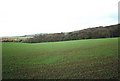
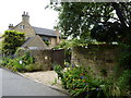
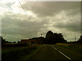
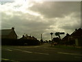
50 photos from this area
Area Information
Key information about the S44 5LY including its size, population, and administrative classification.
- Area Type
- Postcode
- Area Size
- 12.1 hectares
- Population
- 1561
- Population Density
- 498 people/km²
House Prices in S44 5LY
34
Properties
£179,079
Average Sold Price
£32,000
Lowest Price
£525,000
Highest Price
Showing 34 properties
| Address | Type | Beds | Baths | Last Sale Price | Last Sale Date | |
|---|---|---|---|---|---|---|
| 16 The Hill, Glapwell, S44 5LY | Semi-detached | 3 | 1 | £204,750 | Nov 2024 | |
| 32 The Hill, Glapwell, S44 5LY | Semi-detached | 3 | 1 | £180,000 | Aug 2024 | |
| 52 The Hill, Glapwell, S44 5LY | Retail | 3 | 2 | £290,000 | Jun 2022 | |
| 4 The Hill, Glapwell, S44 5LY | Detached | 5 | 2 | £525,000 | Jan 2021 | |
| 6 The Hill, Glapwell, S44 5LY | Detached | 4 | 3 | £315,000 | Nov 2019 | |
| 70 The Hill, Glapwell, S44 5LY | Bungalow | 3 | - | £320,000 | Sep 2019 | |
| 34 The Hill, Glapwell, S44 5LY | Semi-detached | 3 | 1 | £133,000 | Oct 2018 | |
| 36 The Hill, Glapwell, S44 5LY | Semi-detached | - | - | £140,000 | Jun 2017 | |
| 28 The Hill, Glapwell, S44 5LY | Semi-detached | 3 | 1 | £210,000 | May 2017 | |
| 66 The Hill, Glapwell, S44 5LY | Terraced | 4 | 2 | £234,000 | Dec 2016 |
Page 1 of 4
Energy Efficiency in S44 5LY
Amenities
Schools
| Rank | School | Type | Entry gender | Ages |
|---|
Explore more schools in this area
Go to Schools tabDemographics
Household Size
Two person
most common
Accommodation Type
Houses
most common
Tenure
73
majority
Ethnic Group
White
most common
Religion
N/A
most common
Household Composition
N/A
most common
Age
47
median
Adults (30-64 years)
most common
Household Deprivation
N/A
with no deprivation
NS-SEC
28
in Lower managerial occupations
Explore more demographic insights in this area
Go to Demographics tabPlanning
Planning Constraints
- Flood RiskPremium
- Ramsar Wetland SitesPremium
- Area of Outstanding Natural BeautyPremium
- Protected Nature ReservePremium
- Protected WoodlandPremium