Area Overview for S43 4PB
Photos of S43 4PB

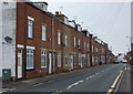

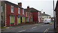


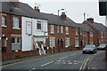


47 photos from this area
Area Information
Key information about the S43 4PB including its size, population, and administrative classification.
- Area Type
- Postcode
- Area Size
- 1.6 hectares
- Population
- 2350
- Population Density
- 919 people/km²
House Prices in S43 4PB
58
Properties
£75,667
Average Sold Price
£4,000
Lowest Price
£173,000
Highest Price
Showing 58 properties
| Address | Type | Beds | Baths | Last Sale Price | Last Sale Date | |
|---|---|---|---|---|---|---|
| 48 Chapel Close, Clowne, S43 4PB | Flat | 2 | 1 | £98,000 | Feb 2025 | |
| 26 Chapel Close, Clowne, S43 4PB | Flat | 2 | 1 | £105,000 | Jun 2024 | |
| 44 Chapel Close, Clowne, S43 4PB | Flat | - | - | £85,000 | Sep 2022 | |
| 32 Chapel Close, Clowne, S43 4PB | Flat | 2 | 1 | £90,000 | May 2022 | |
| 51 Chapel Close, Clowne, S43 4PB | Flat | - | - | £70,000 | Jan 2022 | |
| 53 Chapel Close, Clowne, S43 4PB | Flat | - | - | £65,000 | Dec 2021 | |
| 22 Chapel Close, Clowne, S43 4PB | Bungalow | - | - | £169,950 | Apr 2021 | |
| 10 Chapel Close, Clowne, S43 4PB | Detached | 2 | 1 | £173,000 | Feb 2021 | |
| 3 Chapel Close, Clowne, S43 4PB | Bungalow | - | - | £155,000 | Sep 2020 | |
| 61 Chapel Close, Clowne, S43 4PB | Flat | - | - | £63,000 | May 2020 |
Page 1 of 6
Energy Efficiency in S43 4PB
Amenities
Schools
| Rank | School | Type | Entry gender | Ages |
|---|
Explore more schools in this area
Go to Schools tabDemographics
Household Size
Two person
most common
Accommodation Type
Houses
most common
Tenure
71
majority
Ethnic Group
White
most common
Religion
N/A
most common
Household Composition
N/A
most common
Age
47
median
Adults (30-64 years)
most common
Household Deprivation
N/A
with no deprivation
NS-SEC
28
in Lower managerial occupations
Explore more demographic insights in this area
Go to Demographics tabPlanning
Planning Constraints
- Flood RiskPremium
- Ramsar Wetland SitesPremium
- Area of Outstanding Natural BeautyPremium
- Protected Nature ReservePremium
- Protected WoodlandPremium