Area Overview for S43 4AB
Photos of S43 4AB
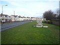
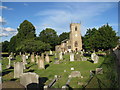
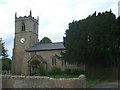
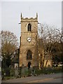
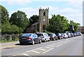
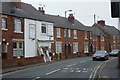
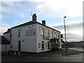
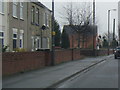
47 photos from this area
Area Information
Key information about the S43 4AB including its size, population, and administrative classification.
- Area Type
- Postcode
- Area Size
- 3.7 hectares
- Population
- 2350
- Population Density
- 919 people/km²
House Prices in S43 4AB
20
Properties
£107,150
Average Sold Price
£27,850
Lowest Price
£275,000
Highest Price
Showing 20 properties
| Address | Type | Beds | Baths | Last Sale Price | Last Sale Date | |
|---|---|---|---|---|---|---|
| 9 Station Road, Clowne, S43 4AB | house | 1 | 1 | £120,000 | Aug 2022 | |
| 11 Station Road, Clowne, S43 4AB | Semi-detached | 1 | 2 | £70,000 | Sep 2021 | |
| 35 Station Road, Clowne, S43 4AB | house | - | - | £72,500 | Feb 2017 | |
| 43 Station Road, Clowne, S43 4AB | house | - | - | £105,995 | Dec 2010 | |
| 28A Station Road, Clowne, S43 4AB | Bungalow | 3 | 2 | £275,000 | Apr 2008 | |
| 31 Station Road, Clowne, S43 4AB | Terraced | - | - | £87,500 | Feb 2007 | |
| 28 Station Road, Clowne, S43 4AB | Detached | - | - | £224,000 | May 2006 | |
| 39 Station Road, Clowne, S43 4AB | Detached | 3 | 1 | £126,000 | Apr 2005 | |
| 41 Station Road, Clowne, S43 4AB | house | - | - | £67,000 | Feb 2003 | |
| 37 Station Road, Clowne, S43 4AB | Detached | 3 | 2 | £55,000 | Jun 1997 |
Page 1 of 2
Energy Efficiency in S43 4AB
Amenities
Schools
| Rank | School | Type | Entry gender | Ages |
|---|
Explore more schools in this area
Go to Schools tabDemographics
Household Size
Two person
most common
Accommodation Type
Houses
most common
Tenure
71
majority
Ethnic Group
White
most common
Religion
N/A
most common
Household Composition
N/A
most common
Age
47
median
Adults (30-64 years)
most common
Household Deprivation
N/A
with no deprivation
NS-SEC
28
in Lower managerial occupations
Explore more demographic insights in this area
Go to Demographics tabPlanning
Planning Constraints
- Flood RiskPremium
- Ramsar Wetland SitesPremium
- Area of Outstanding Natural BeautyPremium
- Protected Nature ReservePremium
- Protected WoodlandPremium