Area Overview for S43 1QQ
Photos of S43 1QQ
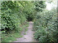
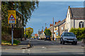
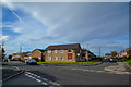
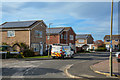
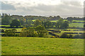

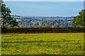
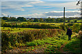
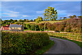
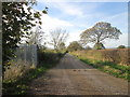
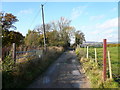
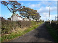
27 photos from this area
Area Information
Key information about the S43 1QQ including its size, population, and administrative classification.
- Area Type
- Postcode
- Area Size
- 42.2 hectares
- Population
- 1328
- Population Density
- 667 people/km²
House Prices in S43 1QQ
11
Properties
£396,250
Average Sold Price
£132,500
Lowest Price
£635,000
Highest Price
Showing 11 properties
| Address | Type | Beds | Baths | Last Sale Price | Last Sale Date | |
|---|---|---|---|---|---|---|
| Tapton Hall Barn, Balmoak Lane, Tapton, S43 1QQ | Detached | 3 | 2 | £635,000 | Feb 2021 | |
| Crewe Cottage, Unnamed Road From Balmoak Lane To Manor And Tapton Cottages, Chesterfield, S43 1QQ | house | 3 | 2 | £470,000 | Aug 2019 | |
| Tapton Manor, Unnamed Road From Balmoak Lane To Manor And Tapton Cottages, Chesterfield, S43 1QQ | house | - | - | £490,000 | Jun 2013 | |
| Swiss Cottage, Unnamed Road From Balmoak Lane To Manor And Tapton Cottages, Chesterfield, S43 1QQ | house | - | - | £215,000 | Mar 2009 | |
| Tapton Grange, Unnamed Road From Balmoak Lane To Manor And Tapton Cottages, Chesterfield, S43 1QQ | Semi-detached | - | - | £435,000 | Sep 2003 | |
| Mistle, Balmoak Lane, Tapton, S43 1QQ | Detached | 3 | - | £132,500 | Jan 1995 | |
| Manor Cottage, Unnamed Road From Balmoak Lane To Manor And Tapton Cottages, Chesterfield, S43 1QQ | Detached | 4 | 3 | - | - | |
| City Farm, Unnamed Road From Dark Lane To City Farm, Chesterfield, S43 1QQ | Detached | - | - | - | - | |
| Tapton Hall Farm, Balmoak Lane, Tapton, S43 1QQ | Detached | - | - | - | - | |
| The Stables At Tapton Grove, Balmoak Lane, Tapton, S43 1QQ | Leisure | - | - | - | - |
Page 1 of 2
Energy Efficiency in S43 1QQ
Amenities
Schools
| Rank | School | Type | Entry gender | Ages |
|---|
Explore more schools in this area
Go to Schools tabDemographics
Household Size
Two person
most common
Accommodation Type
Houses
most common
Tenure
89
majority
Ethnic Group
White
most common
Religion
N/A
most common
Household Composition
N/A
most common
Age
47
median
Adults (30-64 years)
most common
Household Deprivation
N/A
with no deprivation
NS-SEC
39
in Lower managerial occupations
Explore more demographic insights in this area
Go to Demographics tabPlanning
Planning Constraints
- Flood RiskPremium
- Ramsar Wetland SitesPremium
- Area of Outstanding Natural BeautyPremium
- Protected Nature ReservePremium
- Protected WoodlandPremium