Area Overview for S41 0TN
Photos of S41 0TN
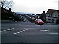
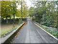
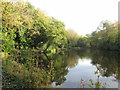
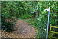
39 photos from this area
Area Information
Key information about the S41 0TN including its size, population, and administrative classification.
- Area Type
- Postcode
- Area Size
- 1.7 hectares
- Population
- 1328
- Population Density
- 667 people/km²
House Prices in S41 0TN
30
Properties
£198,931
Average Sold Price
£14,500
Lowest Price
£410,000
Highest Price
Showing 30 properties
| Address | Type | Beds | Baths | Last Sale Price | Last Sale Date | |
|---|---|---|---|---|---|---|
| 28 Paxton Road, Tapton, S41 0TN | Detached | 3 | 1 | £261,000 | Jan 2022 | |
| 36 Paxton Road, Tapton, S41 0TN | house | - | - | £410,000 | Sep 2021 | |
| 56 Paxton Road, Tapton, S41 0TN | Detached | 3 | 1 | £267,000 | Dec 2019 | |
| 46 Paxton Road, Tapton, S41 0TN | Detached | 3 | 2 | £275,000 | Jun 2017 | |
| 58 Paxton Road, Tapton, S41 0TN | Bungalow | - | - | £205,000 | May 2017 | |
| 44 Paxton Road, Tapton, S41 0TN | Semi-detached | 3 | 1 | £215,000 | Jul 2016 | |
| 68 Paxton Road, Tapton, S41 0TN | Detached | 3 | 2 | £270,000 | Sep 2015 | |
| 60 Paxton Road, Tapton, S41 0TN | Semi-detached | 3 | 2 | £197,500 | Jul 2015 | |
| 16 Paxton Road, Tapton, S41 0TN | Detached | 3 | 2 | £237,500 | Apr 2014 | |
| 38 Paxton Road, Tapton, S41 0TN | Detached | - | - | £100,000 | Nov 2011 |
Page 1 of 3
Energy Efficiency in S41 0TN
Amenities
Schools
| Rank | School | Type | Entry gender | Ages |
|---|
Explore more schools in this area
Go to Schools tabDemographics
Household Size
Two person
most common
Accommodation Type
Houses
most common
Tenure
89
majority
Ethnic Group
White
most common
Religion
N/A
most common
Household Composition
N/A
most common
Age
47
median
Adults (30-64 years)
most common
Household Deprivation
N/A
with no deprivation
NS-SEC
39
in Lower managerial occupations
Explore more demographic insights in this area
Go to Demographics tabPlanning
Planning Constraints
- Flood RiskPremium
- Ramsar Wetland SitesPremium
- Area of Outstanding Natural BeautyPremium
- Protected Nature ReservePremium
- Protected WoodlandPremium