Area Overview for S41 9DX
Photos of S41 9DX


Area Information
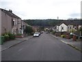
S41 9DX is a small, tightly clustered residential area in England defined by its postcode rather than a broader ward. The total land size covers only 1622 square metres, which supports a population of 1559 residents. This density results in a figure of 425 people per square kilometre, creating a concentrated living environment typical of established suburbs. Life here revolves around immediate neighbourhood connections rather than sprawling estates. The area functions as a distinct pocket within the wider Chesterfield postal district, offering a sense of familiarity among residents. You will find a community where boundaries are clearly defined by the specific postcode grid. Daily life centres on walking distances to local services and avoiding long commutes within the immediate zone. The compact nature means infrastructure is focused, and the area does not stretch into larger administrative zones. Prospective buyers looking for a specific postcode location values this clarity. Living in S41 9DX means accepting a high population density within a very small geographic footprint. This creates a close-knit atmosphere where every resident is part of the same immediate cluster.
- Area Type
- Postcode
- Area Size
- 1622 m²
- Population
- 1559
- Population Density
- 425 people/km²
The property market in S41 9DX is characterised by a strong foundation of private ownership rather than a rental dependency. With a home ownership level standing at 65%, the vast majority of residents have purchased their properties outright or via mortgage. This figure indicates a healthy, settled market where buyers have invested in the local area. All accommodation in this specific postcode is classified as houses, ruling out the existence of flats or converted rentals within the 1622 square metre zone. This uniformity means buyers looking specifically for traditional housing stock will find their requirements met here. The area is not a hub for international students or young professionals seeking urban flats. Instead, it caters to families and couples who value single-family living spaces. Homes in S41 9DX are therefore likely to be family-oriented in design and layout. When searching for properties, you should expect a stock that aligns with domestic living needs rather than student housing. The lack of rental prevalence suggests lower turnover rates compared to bustling rental districts. This stability makes the area attractive for long-term investment for those who can enter the market.
House Prices in S41 9DX
Showing 2 properties
| Address | Type | Beds | Baths | Last Sale Price | Last Sale Date | |
|---|---|---|---|---|---|---|
| 621 Sheffield Road, Sheepbridge, S41 9DX | Semi-detached | - | - | - | - | |
| 623 Sheffield Road, Sheepbridge, S41 9DX | Semi-detached | 2 | 1 | - | - |
Energy Efficiency in S41 9DX
Daily life in S41 9DX benefits from a selection of retail and transport hubs within practical reach. Five distinct retail venues are available nearby, including Lidl Newbold, Tesco Chesterfield, and Spar. These supermarkets provide comprehensive shopping needs without requiring long journeys into the city centre. For commuters, three railway stations offer rail connections: Chesterfield Railway Station, Dronfield Railway Station, and Dore & Totley Railway Station. This network gives you flexibility in choosing routes depending on your destination. A Coach Station is also on hand for longer-distance travel when railways are not suitable. Beyond trains, the area boasts five metro or transport platform options including Herdings Park Platform, Herdings, and White Lane. These stop-points support local mobility across the wider region. The presence of Tesco Chesterfield suggests access to larger supermarket choices beyond the immediate cluster. Living in S41 9DX means balancing a compact residential life with direct access to major retail parks and transport interchanges. You can run errands, travel to work, and manage household needs efficiently using these established local amenities.
Amenities
Schools
Families in S41 9DX have access to several educational institutions located nearby, providing varied schooling options. Mary Swanwick Community Primary School is a primary school in the vicinity. Mary Swanwick Primary School also holds a 'good' Ofsted rating, demonstrating a level of educational quality that parents can verify. For children requiring specialised support, Holly House Special School is available to cater to specific learning needs. Additionally, Holly House operates as another facility in the area, though its specific type is listed generally. This mix ensures that primary education is supported by both standard and special needs provisions. You do not need to travel far to find these educational resources close to your home. The presence of multiple schools with similar names, such as the two listings for Holly House, indicates a range of services under one or related brand identifiers. Parents planning to move to S41 9DX can rest easy knowing that primary-level education is well-represented locally. The area supports early years development through Mary Swanwick Community Primary School while offering alternative pathways through the other Holly House facilities.
| Rank | School | Type | Entry gender | Ages |
|---|
Explore more schools in this area
Go to Schools tabDemographics
The community in S41 9DX reflects a mature demographic profile driven by its housing stock and location. The median age sits at 47 years, indicating an area dominated by adults aged between 30 and 64 years. This age range suggests a population settled enough to own property but still active in the workforce or caring for older relatives. Conversely, there is a lower concentration of young children or elderly retirees compared to the median age indicates. You will find that 65% of households are owner-occupied, confirming that most residents have bought homes rather than renting. This high ownership rate points to financial stability and long-term residency among the majority of the 1559 people who call S41 9DX home. The accommodation type is exclusively houses, meaning you will not find apartments or flats in this specific postcode cluster. While the predominant ethnic group is White, the data confirms a standard demographic distribution without noting significant migration patterns. Living in S41 9DX means joining a community of mostly homeowners with stable family units. The absence of frequent turnover is visible in the high percentage of owner-occupied dwellings. This demographic stability contributes to a quiet, predictable environment for those seeking a house rather than an apartment.
Household Size
Accommodation Type
Tenure
Ethnic Group
Religion
Household Composition
Age
Household Deprivation
NS-SEC
Explore more demographic insights in this area
Go to Demographics tabPlanning
Planning Constraints
- Flood RiskPremium
- Ramsar Wetland SitesPremium
- Area of Outstanding Natural BeautyPremium
- Protected Nature ReservePremium
- Protected WoodlandPremium