Area Overview for S33 6RZ
Photos of S33 6RZ
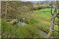
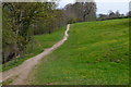
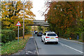
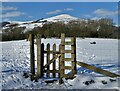
50 photos from this area
Area Information
Key information about the S33 6RZ including its size, population, and administrative classification.
- Area Type
- Postcode
- Area Size
- 11.2 hectares
- Population
- 1122
- Population Density
- 85 people/km²
House Prices in S33 6RZ
10
Properties
£266,375
Average Sold Price
£161,500
Lowest Price
£335,000
Highest Price
Showing 10 properties
| Address | Type | Beds | Baths | Last Sale Price | Last Sale Date | |
|---|---|---|---|---|---|---|
| Apprentice Croft, Castleton Road, Hope, S33 6RZ | Bungalow | - | - | £335,000 | May 2013 | |
| Bridgefield, Castleton Road, Hope, S33 6RZ | Detached | - | - | £320,000 | Nov 2008 | |
| Houghbrook, Castleton Road, Hope, S33 6RZ | Detached | - | - | £249,000 | May 2002 | |
| Hall Croft, Castleton Road, Hope, S33 6RZ | Bungalow | - | - | £161,500 | Dec 2001 | |
| Beechcroft, Castleton Road, Hope, S33 6RZ | Bungalow | 3 | - | - | - | |
| Torre, Castleton Road, Hope, S33 6RZ | Detached | - | - | - | - | |
| Beech Lane House, Castleton Road, Hope, S33 6RZ | Detached | - | - | - | - | |
| Brookstones, Castleton Road, Hope, S33 6RZ | Detached | - | - | - | - | |
| Marsh Farm, Castleton Road, Hope, S33 6RZ | Detached | 3 | 1 | - | - | |
| Overdale Mobile Veterinary Surgery, Marsh Farm, Castleton Road, Hope, S33 6RZ | commercial | - | - | - | - |
Energy Efficiency in S33 6RZ
Amenities
Schools
| Rank | School | Type | Entry gender | Ages |
|---|
Explore more schools in this area
Go to Schools tabDemographics
Household Size
Two person
most common
Accommodation Type
Houses
most common
Tenure
70
majority
Ethnic Group
White
most common
Religion
N/A
most common
Household Composition
N/A
most common
Age
47
median
Adults (30-64 years)
most common
Household Deprivation
N/A
with no deprivation
NS-SEC
37
in Lower managerial occupations
Explore more demographic insights in this area
Go to Demographics tabPlanning
Planning Constraints
- Flood RiskPremium
- Ramsar Wetland SitesPremium
- Area of Outstanding Natural BeautyPremium
- Protected Nature ReservePremium
- Protected WoodlandPremium