Area Overview for S33 6RD
Photos of S33 6RD
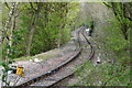
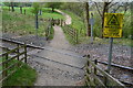
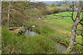
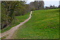
50 photos from this area
Area Information
Key information about the S33 6RD including its size, population, and administrative classification.
- Area Type
- Postcode
- Area Size
- 15.4 hectares
- Population
- 1122
- Population Density
- 85 people/km²
House Prices in S33 6RD
48
Properties
£270,128
Average Sold Price
£64,000
Lowest Price
£520,000
Highest Price
Showing 48 properties
| Address | Type | Beds | Baths | Last Sale Price | Last Sale Date | |
|---|---|---|---|---|---|---|
| 56 Castleton Road, Hope, S33 6RD | Semi-detached | 3 | 1 | £285,000 | Feb 2025 | |
| Half Acre, 70 Castleton Road, Hope, S33 6RD | Bungalow | 3 | 1 | £520,000 | Jun 2024 | |
| 44 Castleton Road, Hope, S33 6RD | Semi-detached | 4 | 2 | £367,000 | Aug 2023 | |
| 62 Castleton Road, Hope, S33 6RD | Semi-detached | 3 | 1 | £301,000 | Jul 2022 | |
| 16 Castleton Road, Hope, S33 6RD | house | - | - | £473,000 | Dec 2021 | |
| 72 Castleton Road, Hope, S33 6RD | house | - | - | £375,000 | Jun 2021 | |
| 14 Castleton Road, Hope, S33 6RD | house | - | - | £230,000 | Aug 2020 | |
| 48 Castleton Road, Hope, S33 6RD | Bungalow | - | - | £420,000 | Jan 2020 | |
| 38 Castleton Road, Hope, S33 6RD | house | - | - | £355,000 | Jan 2018 | |
| 36 Castleton Road, Hope, S33 6RD | house | 3 | - | £235,000 | Jul 2016 |
Page 1 of 5
Energy Efficiency in S33 6RD
Amenities
Schools
| Rank | School | Type | Entry gender | Ages |
|---|
Explore more schools in this area
Go to Schools tabDemographics
Household Size
Two person
most common
Accommodation Type
Houses
most common
Tenure
70
majority
Ethnic Group
White
most common
Religion
N/A
most common
Household Composition
N/A
most common
Age
47
median
Adults (30-64 years)
most common
Household Deprivation
N/A
with no deprivation
NS-SEC
37
in Lower managerial occupations
Explore more demographic insights in this area
Go to Demographics tabPlanning
Planning Constraints
- Flood RiskPremium
- Ramsar Wetland SitesPremium
- Area of Outstanding Natural BeautyPremium
- Protected Nature ReservePremium
- Protected WoodlandPremium