Area Overview for PE9 4LQ
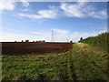
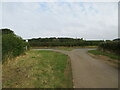
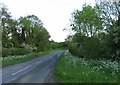
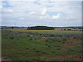
Photos of PE9 4LQ


Area Information
Living in PE9 4LQ offers a defined residential experience within a cluster covering just 1.5 km². This specific postcode serves approximately 1,588 people, creating a compact community where neighbours are often within sight of one another. The area is situated in England, providing a settled environment for those seeking a smaller footprint rather than the sprawl of a major urban centre. You can expect a village-like feel where daily routines are manageable and distances are short. The population density averages 134 people per km², indicating a moderate spread of homes that avoids the overcrowding found in city cores. This locality functions as a self-contained unit where residents can manage most daily needs without travelling far. The character of PE9 4LQ is shaped by its small size, making it ideal for individuals or families who value a tighter-knit atmosphere. It is a place where the boundaries are clear, and the surroundings are readily accessible. For someone looking to purchase, this area represents a specific slice of property market that balances isolation with practical connectivity to wider services outside the immediate cluster.
- Area Type
- Postcode
- Area Size
- 1.5 km²
- Population
- 1588
- Population Density
- 134 people/km²
The housing stock in PE9 4LQ is characterised by a strong preference for owner-occupied properties, with 84% of homes belonging to their current residents. This statistic points to a market dominated by households that have chosen to buy rather than rent, likely driven by the area's suitability for long-term living. Houses comprise the main type of accommodation available, suggesting that buyers will find a range of detached, semi-detached, or terraced family homes rather than modern apartment developments. This type of housing usually appeals to those needing space and traditional layouts. The high percentage of homeownership implies that price fluctuations here may be influenced differently than in rental-heavy urban centres. Potential buyers looking at PE9 4LQ should anticipate a market where selling also takes time, as owners are less likely to move frequently. The consistency in accommodation type means property values are set against comparable house structures. This creates a predictable environment for investors or first-home buyers who wish to understand the local value landscape without navigating a mixed-market complexity. The focus remains firmly on substantial housing that supports family life and employment stability.
House Prices in PE9 4LQ
Showing 14 properties
| Address | Type | Beds | Baths | Last Sale Price | Last Sale Date | |
|---|---|---|---|---|---|---|
| 6A Stamford Road, Essendine, PE9 4LQ | Bungalow | - | - | £565,000 | May 2021 | |
| Innisfree, 4 Stamford Road, Essendine, PE9 4LQ | Bungalow | 3 | 1 | £338,500 | Aug 2020 | |
| Joselee, Stamford Road, Essendine, PE9 4LQ | house | 5 | - | £250,000 | Sep 2012 | |
| 8 Stamford Road, Essendine, PE9 4LQ | Bungalow | 3 | - | £282,970 | Jul 2012 | |
| Ashbridge, Stamford Road, Essendine, PE9 4LQ | house | - | - | £247,500 | Sep 2010 | |
| 3 Stamford Road, Essendine, PE9 4LQ | Bungalow | 3 | 1 | £198,000 | Oct 2002 | |
| Squirrel Lodge, 2 Stamford Road, Essendine, PE9 4LQ | Bungalow | 4 | 1 | - | - | |
| 7 Stamford Road, Essendine, PE9 4LQ | Retail | 3 | 1 | - | - | |
| Woodhurst, 6 Stamford Road, Essendine, PE9 4LQ | Bungalow | 3 | - | - | - | |
| The Bungalows, 1 Stamford Road, Essendine, PE9 4LQ | Detached | - | - | - | - |
Energy Efficiency in PE9 4LQ
Your daily life in PE9 4LQ is supported by a practical network of amenities reached within easy reach. Public transport is anchored by a Bus Interchange, providing access to wider regional networks. For commuters, Stamford Railway Station offers a rail connection, giving you the choice to travel by train for longer distances. Retail needs are met by five shops located nearby, including Sainsburys Stamford, Lidl Stamford and Spar. These supermarkets and convenience stores allow you to buy groceries, fresh produce, and everyday essentials without venturing far from home. The availability of these named retailers means you have established chains for your shopping requirements alongside local convenience options. There are no shopping centres or arcades mentioned in the immediate vicinity, so your visits will focus on these specific outlet locations. Dining options and leisure facilities are limited to the broader Stamford context accessed via these transport links. This setup suits residents who value convenience and practical shopping over the variety of a large town centre. You can handle weekly shopping and commuter travel efficiently from the comfort of your local postcode area.
Amenities
Schools
Families residing in PE9 4LQ have access to two specific educational institutions within the area. Ryhall CofE Primary School serves the needs of younger children, offering a primary education setting for early years students. Older children and teenagers can attend Ryhall CofE Academy, which holds a Good rating from Ofsted. This consistent Good rating for the academy indicates a standard of education that meets Department for Education requirements and suggests a reliable learning environment. The presence of both a primary school and an academy with a positive Ofsted rating ensures that children in the postcode do not need to travel far to begin their education or finish their compulsory schooling. The mix of Church of England education in both institutions provides a specific religious and cultural context for the curriculum. Families moving to PE9 4LQ can expect local options that cover the full spectrum of early to secondary education. While secondary details for the academy are limited in the available records, the established rating provides a baseline of quality for prospective parents. This educational infrastructure supports the demographic reality of an area with a median age of 47, where older children remain or return to the community.
| Rank | School | Type | Entry gender | Ages |
|---|
Explore more schools in this area
Go to Schools tabDemographics
The community in PE9 4LQ reflects a mature population, with a median age of 47 years old. The majority of residents fall into the adult range between 30 and 64 years, suggesting that the area attracts career-focused individuals rather than large numbers of teenagers or young children. Home ownership stands at an impressive 84%, meaning the vast majority of people here own their homes outright or with a mortgage rather than renting. This high ownership rate indicates stability and a long-term commitment to the locality. Houses form the predominant accommodation type throughout the postcode, catering to families and those who prefer detached or semi-detached living over flats or apartments. The demographic makeup is predominantly White, contributing to a homogenous community profile. This statistical snapshot paints a picture of an established neighbourhood where adult lifestyles and established households define the social fabric. Residents are likely to be settled in their current homes for extended periods, fostering a stable environment that prioritises quiet and security over rapid turnover or high energy from transient populations.
Household Size
Accommodation Type
Tenure
Ethnic Group
Religion
Household Composition
Age
Household Deprivation
NS-SEC
Explore more demographic insights in this area
Go to Demographics tabPlanning
Planning Constraints
- Flood RiskPremium
- Ramsar Wetland SitesPremium
- Area of Outstanding Natural BeautyPremium
- Protected Nature ReservePremium
- Protected WoodlandPremium